Kanton L'Argentière-la-Bessée
| Kanton L'Argentière-la-Bessée | |
|---|---|
| Geografie | |
| Hlavní město | L'Argentière-la-Bessée |
| Souřadnice | 44°47′40″ s. š., 6°33′33″ v. d. |
| Rozloha | 462,84 km² |
| Geodata (OSM) | OSM, WMF |
| Obyvatelstvo | |
| Počet obyvatel | 6 596 (2009) |
| Hustota zalidnění | 14,3 obyv./km² |
| Správa regionu | |
| Stát | Francie Francie Francie |
| Region | Provence-Alpes-Côte d'Azur |
| Departement | Hautes-Alpes |
| Arrondissement | Briançon |
| Druh celku | Kanton |
| Podřízené celky | Obce (počet: 9) |
| Vznik | 22. března 2015 |
| Některá data mohou pocházet z datové položky. | |
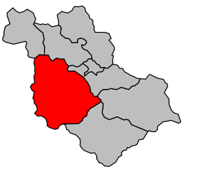
Kanton L'Argentière-la-Bessée (fr. Canton de L'Argentière-la-Bessée) je francouzský kanton v departementu Hautes-Alpes v regionu Provence-Alpes-Côte d'Azur. Tvoří ho devět obcí.
Obce kantonu
- L'Argentière-la-Bessée
- Champcella
- Freissinières
- Pelvoux
- Puy-Saint-Vincent
- La Roche-de-Rame
- Saint-Martin-de-Queyrières
- Vallouise
- Les Vigneaux
 | Tento článek je příliš stručný nebo postrádá důležité informace. Pomozte Wikipedii tím, že jej vhodně rozšíříte. Nevkládejte však bez oprávnění cizí texty. |
| Kantony v departementu Hautes-Alpes | ||
|---|---|---|
| Aiguilles • L'Argentière-la-Bessée • Aspres-sur-Buëch • Barcillonnette • La Bâtie-Neuve • Briançon-Nord • Briançon-Sud • Chorges • Embrun • Gap-Campagne • Gap-Centre • Gap-Nord-Est • Gap-Nord-Ouest • Gap-Sud-Est • Gap-Sud-Ouest • La Grave • Guillestre • Laragne-Montéglin • Le Monêtier-les-Bains • Orcières • Orpierre • Ribiers • Rosans • Saint-Bonnet-en-Champsaur • Saint-Étienne-en-Dévoluy • Saint-Firmin • Savines-le-Lac • Serres • Tallard • Veynes |  | |
Portály: Francie


