Anse Boileau
District in Seychelles

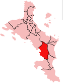
Location within Seychelles
(2019 Estimate)[1]
Anse Boileau (French pronunciation: [ɑ̃s bwalo]) is an administrative district on the south of the island of Mahé in the Seychelles. Anse Boileau encapsulates the natural wonders of the Seychelles: it sits at the foot of a steep, green mountain, it is on the shores of the Indian Ocean, and in its midst are streams, mini-forests, creeks, ponds, and an enchanting array of all that defines the Seychellois landscape. It is often described as a fishing village because many of the local residents fish for a living. It has a school, a restaurant, a number of grocery shops, a health centre, and a police station. It is a short distance away from Anse La Mouche, a popular tourist destination. Anse Boileau is so-called because of its many coves.[4]

References
- ^ "POPULATION AND VITAL STATISTICS MID YEAR POPULATION ESTIMATES 2019". Statistical Bulletin. Victoria, Mahe, Seychelles: National Bureau of Statistics Seychelles. 2019-08-30. p. 17 (Table 10). Retrieved 2020-01-08.
- ^ "ANSE BOILEAU". District Profile. Local Government Seychelles. Retrieved 2020-01-10.
- ^ "Anse Boileau - Hon. Phillip Arissol". Directly Elected Members by Constituency. The National Assembly of Seychelles. 2016-10-17. Retrieved 2020-01-11.
- ^ Agency, United States Central Intelligence. The World Factbook (1990).
External links
- Anse Boileau review of the beach
- v
- t
- e
Districts of Seychelles
Central Mahé
- Bel Air
- Les Mamelles
- Mont Buxton
- English River
- Mont Fleuri
- Plaisance
- Saint Louis
- Roche Caiman

- Anse Etoile
- Beau Vallon
- Glacis
- Ile Perseverance I
- Ile Perseverance II
- Anse aux Pins
- Au Cap
- Cascade
- Pointe La Rue
- Anse Royale
- Baie Lazare
- Takamaka
- Anse Boileau
- Port Glaud
- Bel Ombre
- Grand'Anse Mahé
- Baie Saint Anne
- Grand'Anse Praslin
- La Digue and Inner Islands
- Outer Islands
| Authority control databases: Geographic |
|
|---|
4°42′S 55°29′E / 4.700°S 55.483°E / -4.700; 55.483
 | This Seychelles location article is a stub. You can help Wikipedia by expanding it. |
- v
- t
- e


 Anse_Boileau