Barmasia railway station
Railway station in Jharkhand, India
24°13′28″N 87°23′16″E / 24.2244927°N 87.3877729°E / 24.2244927; 87.3877729
| Preceding station | Following station | |||
|---|---|---|---|---|
| Kurwa towards Rampurhat Junction | Eastern Railway zone | Ambajora Shikaripara towards Jasidih Junction | ||
Location | |
|---|---|
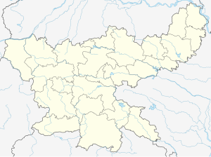  Barmasia railway station Location in Jharkhand |
Jasidih–Dumka–Rampurhat line | ||||||||||||||||||||||||||||||||||||||||||||||||||||||||||||||||||||||||||||||||||||||||||||||||||||||||||||||||||||||||||||||||||||||||||||||||||||||||||||||||||||||||||||||||||||||||||||||||||||||||||||||||||||||||||||||||||||||||||||||||||||||||||||||||||||||||||||||||||||||||||||||||||||||||||||||||||||||||||||||||||||||||||||||||||||||||
|---|---|---|---|---|---|---|---|---|---|---|---|---|---|---|---|---|---|---|---|---|---|---|---|---|---|---|---|---|---|---|---|---|---|---|---|---|---|---|---|---|---|---|---|---|---|---|---|---|---|---|---|---|---|---|---|---|---|---|---|---|---|---|---|---|---|---|---|---|---|---|---|---|---|---|---|---|---|---|---|---|---|---|---|---|---|---|---|---|---|---|---|---|---|---|---|---|---|---|---|---|---|---|---|---|---|---|---|---|---|---|---|---|---|---|---|---|---|---|---|---|---|---|---|---|---|---|---|---|---|---|---|---|---|---|---|---|---|---|---|---|---|---|---|---|---|---|---|---|---|---|---|---|---|---|---|---|---|---|---|---|---|---|---|---|---|---|---|---|---|---|---|---|---|---|---|---|---|---|---|---|---|---|---|---|---|---|---|---|---|---|---|---|---|---|---|---|---|---|---|---|---|---|---|---|---|---|---|---|---|---|---|---|---|---|---|---|---|---|---|---|---|---|---|---|---|---|---|---|---|---|---|---|---|---|---|---|---|---|---|---|---|---|---|---|---|---|---|---|---|---|---|---|---|---|---|---|---|---|---|---|---|---|---|---|---|---|---|---|---|---|---|---|---|---|---|---|---|---|---|---|---|---|---|---|---|---|---|---|---|---|---|---|---|---|---|---|---|---|---|---|---|---|---|---|---|---|---|---|---|---|---|---|---|---|---|---|---|---|---|---|---|---|---|---|---|---|---|---|---|---|---|---|---|---|---|---|---|---|---|---|---|---|---|---|
Legend | ||||||||||||||||||||||||||||||||||||||||||||||||||||||||||||||||||||||||||||||||||||||||||||||||||||||||||||||||||||||||||||||||||||||||||||||||||||||||||||||||||||||||||||||||||||||||||||||||||||||||||||||||||||||||||||||||||||||||||||||||||||||||||||||||||||||||||||||||||||||||||||||||||||||||||||||||||||||||||||||||||||||||||||||||||||||||
| ||||||||||||||||||||||||||||||||||||||||||||||||||||||||||||||||||||||||||||||||||||||||||||||||||||||||||||||||||||||||||||||||||||||||||||||||||||||||||||||||||||||||||||||||||||||||||||||||||||||||||||||||||||||||||||||||||||||||||||||||||||||||||||||||||||||||||||||||||||||||||||||||||||||||||||||||||||||||||||||||||||||||||||||||||||||||


Barmasia railway station (station code BRMA) is at Barmasia village in Dumka district in the Indian state of Jharkhand on the Jasidih – Rampurhat section. It is in the Howrah Division of the Eastern Railway zone of the Indian Railways. It has an average elevation of 158 metres (518 ft).
The railway line has single 5 ft 6 in (1,676 mm) broad gauge track from Jasidih Junction in Deoghar district in Santhal Pargana division of Jharkhand to Rampurhat in Birbhum district of West Bengal. This railway track to Dumka is a boon for Santhal Pargana Division.
The Barmasia railway station offers rail connectivity to the nearby villages of Gopalpur, Syampur, Bucham, Kuspahari, and Patabari.
History
Barmasia railway station became operation in 2014. The 64 km (40 mi) segment from Dumka to Rampurhat became operational on 30 June 2014.[1]
Station layout
| G | Street level | Exit/Entrance & ticket counter |
| P1 | Side platform, No-1 doors will open on the left/right | |
| Track 1 | Rampurhat ← toward → Jasidih | |
Trains
One passenger train runs between Jasidih Junction and Rampurhat stop at Barmasia railway station.
Track layout
Barmasia railway station track layout | ||||||||||||||||||||||||||||||||||||||||||
|---|---|---|---|---|---|---|---|---|---|---|---|---|---|---|---|---|---|---|---|---|---|---|---|---|---|---|---|---|---|---|---|---|---|---|---|---|---|---|---|---|---|---|
Legend | ||||||||||||||||||||||||||||||||||||||||||
| ||||||||||||||||||||||||||||||||||||||||||
Station with one track and one side platform | ||||||||||||||||||||||||||||||||||||||||||

See also
 India portal
 Trains portal

References
- ^ a b "Dumka–Rampurhat train service flagged off". The Times of India. 5 June 2015. Retrieved 14 December 2018.
External links
Wikivoyage has a travel guide for Rail travel in India.
- Ministry of Railways. (Official site)
- [1]
- Google. "Barmasia Railway station" (Map). Google Maps. Google.
- Official website of the Dumka district


