Beedles Station, Ohio
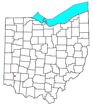
Beedles Station was the first settlement in what was to become Warren County, Ohio, United States. A blockhouse was established there in 1795 in what is now Section 28, Town 4, Range 3 of the Between the Miami Rivers Survey in western Turtlecreek Township. This is on the west side of State Route 741 about a mile south of Otterbein. The settlement was named for William Beedle, an early settler.[1] A historical plaque marks the site.[2]
References
- v
- t
- e
Municipalities and communities of Warren County, Ohio, United States
County seat: Lebanon
- Carlisle‡
- Franklin
- Lebanon
- South Lebanon
- Loveland‡
- Mason
- Middletown‡
- Monroe‡
- Springboro‡

- Blanchester‡
- Butlerville
- Corwin
- Harveysburg
- Maineville
- Morrow
- Pleasant Plain
- Waynesville
communities
- Blackhawk
- Chautauqua‡
- Cozaddale
- Crosswick
- Dallasburg
- Dodds
- Edwardsville
- Fosters
- Genntown
- Greentree Corners
- Gum Grove
- Hagemans Crossing
- Hickoryville
- Hicks
- Hillcrest
- Hopkinsville
- Kenricksville
- Level
- Mathers Mill
- Merrittstown
- Middleboro
- Mount Holly
- Murdoch
- Oregonia
- Osceola
- Pekin
- Red Lion
- Ridgeville
- Rossburg
- San Mar Gale
- Socialville
- Twenty Mile Stand
- Wellman
- Zoar
- Beedles Station
- Browns Store
- Butterworth
- Hammel and Millgrove
- Venable
‡This populated place also has portions in an adjacent county or counties
- Ohio portal
- United States portal
39°26′18″N 84°16′47″W / 39.4384°N 84.2798°W / 39.4384; -84.2798
 | This Warren County, Ohio state location article is a stub. You can help Wikipedia by expanding it. |
- v
- t
- e


