Britswert
Village in Friesland, Netherlands
Britswerd Britswert | |
|---|---|
Village | |
 Britswert church | |
 Flag  Coat of arms | |
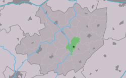 Location in the former Littenseradiel municipality | |
53°6′45″N 5°40′32″E / 53.11250°N 5.67556°E / 53.11250; 5.67556 | |
| Country |  Netherlands Netherlands |
| Province |  Friesland Friesland |
| Municipality |  Súdwest-Fryslân Súdwest-Fryslân |
| Area [1] | |
| • Total | 4.26 km2 (1.64 sq mi) |
| Elevation [2] | 0.2 m (0.7 ft) |
| Population (2021)[1] | |
| • Total | 105 |
| • Density | 25/km2 (64/sq mi) |
| Postal code | 8636[1] |
| Dialing code | 058 |
Britswert (Dutch: Britswerd) is a small village in Súdwest-Fryslân municipality in the province of Friesland, the Netherlands. It had a population of around 112 in January 2017.[3]
History
The village was first mentioned in the late-13th century as Bretsenewarth, and means "broken or split terp.[4] Britswert is a terp (artificial living hill) villages which was located between two lakes. The Britswerdermeer was finally poldered in 1885. The St Joris Church dates from the 12th century,[5] however it was restored after a fire in 1514, and the tower was rebuilt in 1889.[6][5] The village as home to both fishermen and farmers. Between 1200 and 1300, the Middelzee silted, and the village gradually became an agricultural community.[6]
Britswert was home to 120 people in 1840.[6] Before 2018, the village was part of the Littenseradiel municipality.[6]
Gallery
-
 Houses in Britswert
 -
 View on Britswert


References
- ^ a b c "Kerncijfers wijken en buurten 2021". Central Bureau of Statistics. Retrieved 5 April 2022.
- ^ "Postcodetool for 8636VA". Actueel Hoogtebestand Nederland (in Dutch). Het Waterschapshuis. Retrieved 5 April 2022.
- ^ Aantal inwoners per dorp Archived 2017-04-21 at the Wayback Machine - Littenseradiel
- ^ "Britswert - (geografische naam)". Etymologiebank (in Dutch). Retrieved 5 April 2022.
- ^ a b "Britswert". Friesland Wonderland (in Dutch). Retrieved 5 April 2022.
- ^ a b c d "Britswert". Plaatsengids (in Dutch). Retrieved 5 April 2022.
External links
![]() Media related to Britswert at Wikimedia Commons
Media related to Britswert at Wikimedia Commons
- v
- t
- e
Populated places in the municipality of Súdwest-Fryslân
- Bolsward
- Hindeloopen
- IJlst
- Sneek
- Stavoren
- Workum
- Abbegea
- Allingawier
- Arum
- Blauwhuis
- Boazum
- Breezanddijk
- Britswert
- Burgwerd
- Cornwerd
- Dearsum
- Dedgum
- Easterein
- Easterwierrum
- Exmorra
- Ferwoude
- Folsgare
- Gaast
- Gaastmeer
- Gauw
- Goënga
- Greonterp
- Hartwerd
- Heeg
- Hemelum
- Hichtum
- Hidaard
- Hieslum
- Hinnaard
- Hommerts
- Idsegahuizum
- Idzega
- Iens
- Indijk
- It Heidenskip
- Itens
- Jutrijp
- Kimswerd
- Kornwerderzand
- Koudum
- Koufurderrige
- Kûbaard
- Lollum
- Longerhouw
- Lytsewierrum
- Makkum
- Molkwerum
- Nijhuizum
- Nijland
- Oosthem
- Oppenhuizen
- Oudega
- Parrega
- Piaam
- Pingjum
- Poppenwier
- Reahûs
- Raerd
- Rien
- Sandfirden
- Scharl
- Scharnegoutum
- Schettens
- Schraard
- Sibrandabuorren
- Smallebrugge
- Tersoal
- Tirns
- Tjalhuizum
- Tjerkwerd
- Uitwellingerga
- Waaksens
- Warns
- Westhem
- Witmarsum
- Wiuwert
- Wolsum
- Wommels
- Wons
- Woudsend
- Ypecolsga
- Ysbrechtum
- Zurich
 | This Friesland location article is a stub. You can help Wikipedia by expanding it. |
- v
- t
- e


