Bunbury Airport
Airport in Bunbury, Western Australia

YBUN
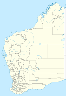
Location in Western Australia
| Direction | Length | Surface | |
|---|---|---|---|
| m | ft | ||
| 07/25 | 1,015 | 3,330 | Asphalt |
Sources: Australian AIP and aerodrome chart[1]
Bunbury Airport (IATA: BUY, ICAO: YBUN) is an airport servicing the Western Australian city of Bunbury. Bunbury Airport is located 8 km (5 mi) south-east of the city centre and is the only airport serving the city. The airport is used largely as a facility for General Aviation, pilot training and emergency services. Bunbury Airport serves an area that includes the City of Bunbury and the surrounding districts of Harvey, Dardanup, Capel and Donnybrook-Balingup.
History
The City of Bunbury is the owner and operator of Bunbury Airport. Council first investigated the possibility of an airstrip in 1965 and with the help of a band of enthusiastic aviators and input from the Department of Civil Aviation, the airstrip became operational in 1969. It has evolved to present day with council funds, government grants/funds, and operational input from the Bunbury Aero Club. The aerodrome is a 'registered' airport with the Civil Aviation Safety Authority (CASA).
Recent upgrades to the airport include the following:
- 2008 – construction of a new Patient Transfer Building to provide better facilities for the approximate 750 annual visits by the Royal Flying Doctor Service (RFDS).
- 2009 – development of an additional 15 hangar sites.
- 2010 – construction of a 700 metre long parallel taxiway.
- 2012 – construction of run-up bays and a helipad.
- 2013 – installation of LED runway and taxiway lighting.
- 2015 – development of an additional 20 hangar sites.
- 2016 – construction of a rescue helicopter base.
- 2017 – installation of an Automatic Weather Information Station (AWIS).
- 2018 – installation of a weather camera, construction of a helipad and installation of a secondary IWI.
Operations and facilities
Bunbury Airport has a single sealed runway, 07/25 which is 1,222 m × 18 m (4,009 ft × 59 ft) wide. Due to the proximity of the South Western Highway, there is a 206 m (676 ft) permanently displaced threshold at the runway 25 end to allow sufficient clearance over the road. Because of this, the available landing distance is 1,015 m (3,330 ft). The airport is currently restricted to aircraft with a maximum take-off weight less than 5,700 kg (12,600 lb).[2] Runway 07/25 is equipped with low intensity, pilot activated runway lighting for night operations. There is no control tower and pilots must co-ordinate arrivals and departures using a Common Traffic Advisory Frequency.
Three flying schools and 1 facility operate out of Bunbury Airport, they are: AirChartersWest,[3] Bunbury Aero Club,[4] Bunbury Flying School[5] and AirSportsWA. The schools and airport are a major Recreational Aviation Australia approved flight training facility.[6]
Bunbury Airport currently averages 13,000 aircraft movements per annum. The airport is home to a permanent rescue helicopter base operated by the Department of Fire & Emergency Services, seasonal water bombers operated by the Parks & Wildlife Services section of the Department of Biodiversity, Conservation and Attractions and significant visitation by the Royal Flying Doctor Service (RFDS).
See also
References
- ^ YBUN – Bunbury (PDF). AIP En Route Supplement from Airservices Australia, effective 13 June 2024, Aeronautical Chart Archived 10 April 2012 at the Wayback Machine
- ^ Bunbury Airport Location Analysis Study Archived 24 March 2012 at the Wayback Machine
- ^ Air Charters West
- ^ Bunbury Aero Club
- ^ Bunbury Flying School
- ^ List of schools in WA Archived 19 March 2012 at the Wayback Machine
External links
- City of Bunbury
- Department of Environment and Conservation
- RFDS
- Airservices Aerodromes & Procedure Charts
Portals:
 Western Australia
 Aviation

- v
- t
- e
- Canberra
- Albury
- Armidale
- Ballina
- Bathurst
- Broken Hill
- Cobar
- Coffs Harbour
- Cooma
- Dubbo
- Grafton
- Griffith
- Lismore
- Lord Howe Island
- Merimbula
- Moree
- Moruya
- Mudgee
- Narrabri
- Narrandera
- Newcastle
- Orange
- Parkes
- Port Macquarie
- Sydney
- Tamworth
- Taree
- Wagga Wagga
- Aurukun
- Badu Island
- Bamaga (Northern Peninsula)
- Barcaldine
- Bedourie
- Birdsville
- Blackall
- Blackwater
- Boigu Island
- Boulia
- Brisbane
- Bundaberg
- Burketown
- Cairns
- Charleville
- Chinchilla
- Cloncurry
- Coconut Island
- Coen
- Cooktown
- Cunnamulla
- Darnley Island
- Dirranbandi
- Doomadgee
- Emerald
- Gladstone
- Gold Coast
- Hamilton Island
- Hervey Bay
- Horn Island
- Hughenden
- Julia Creek
- Karumba
- Kowanyama
- Kubin (Moa Island)
- Lizard Island
- Lockhart River
- Longreach
- Mabuiag Island
- Mackay
- Moranbah
- Mornington Island
- Mount Isa
- Murray Island
- Normanton
- Palm Island
- Quilpie
- Redcliffe
- Richmond
- Rockhampton
- Roma
- Saibai Island
- St George
- Springvale
- Sunshine Coast
- Thangool
- Thargomindah
- Toowoomba (City)
- Toowoomba (Wellcamp)
- Townsville
- Warraber Island
- Weipa
- Whitsunday Coast
- Windorah
- Winton
- Yam Island
- Yorke Island
- Avalon
- Bendigo
- Essendon
- Hamilton
- Melbourne
- Mildura
- Moorabbin
- Mount Hotham
- Portland
- Warrnambool
- Christmas Island
- Cocos (Keeling) Islands
- Norfolk Island
- Wilkins
This lists airports in Australia with scheduled passenger services. Statistics.
Airports in bold are international airports.
Airports in bold are international airports.


 Bunbury_Airport