Canchayllo District
District in Junín, Peru
Canchayllo | |
|---|---|
District | |
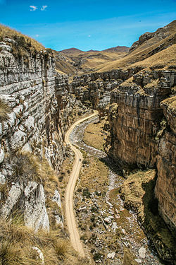 A canyon in the Nor Yauyos-Cochas Landscape Reserve in Canchayllo District | |
| Country |  Peru Peru |
| Region | Junín |
| Province | Jauja |
| Founded | October 15, 1954 |
| Capital | Canchayllo |
| Government | |
| • Mayor | Raul Ricardo Zavala Rojas |
| Area | |
| • Total | 974.69 km2 (376.33 sq mi) |
| Elevation | 3,609 m (11,841 ft) |
| Population (2005 census) | |
| • Total | 2,304 |
| • Density | 2.4/km2 (6.1/sq mi) |
| Time zone | UTC-5 (PET) |
| UBIGEO | 120405 |
Canchayllo District is one of thirty-four districts of the Jauja Province in Peru.[1] Its seat is Canchayllo.
Geography
The district lies in the Nor Yauyos-Cochas Landscape Reserve. The Paryaqaqa mountain range traverses the district. The highest mountain of the district is Paryaqaqa (Tulluqutu) at 5,750 metres (18,865 ft). Other mountains are listed below:[2]
- Ankapa Wachanan
- Anta Qucha
- Aqu Ranra
- Challwa Qucha
- Ch'uychu
- Kima Rumi
- Khuchi Pata
- K'ulluq
- Marayniyuq
- Marka Wat'a
- Mayu Kancha
- Muntiruyuq
- Muyu Pampa
- Pampa Marka
- Pawkara
- Puywan
- Qiwllaqucha
- Qullqa Tampu
- Qullqi P'ukru
- Qura Kancha
- Quriwasi
- Qutu Puyku
- Surawniyuq
- Suyruqucha
- Tuku Mach'ay
- Tunshu
- Ushpa Punta
- Winchus
- Wiraqucha
- Wira Qullpa
- Wiskas
- Yana Urqu
- Yuraq Kancha
- Yuraqqucha
Some of the largest lakes of the province are Antaqucha, Asulqucha, Challwaqucha, Llaksaqucha, Mankhaqucha, Qarwaqucha, Ñawinqucha, Warmiqucha, Wich'iqucha and Yuraqqucha.[2]
See also
References
- ^ (in Spanish) Instituto Nacional de Estadística e Informática. Banco de Información Distrital Archived April 23, 2008, at the Wayback Machine. Retrieved April 11, 2008.
- ^ a b escale.minedu.gob.pe - UGEL map of the Jauja Province (Junín Region)
- v
- t
- e

- Districts of Junín Region
- Peru

- Carhuacallanga
- Chacapampa
- Chicche
- Chilca
- Chongos Alto
- Chupuro
- Colca
- Cullhuas
- El Tambo
- Huacrapuquio
- Hualhuas
- Huancan
- Huancayo
- Huasicancha
- Huayucachi
- Ingenio
- Pariahuanca
- Pilcomayo
- Pucará
- Quichuay
- Quilcas
- San Agustín de Cajas
- San Jerónimo de Tunán
- San Pedro de Saño
- Santo Domingo de Acobamba
- Sapallanga
- Sicaya
- Viques
- Acolla
- Apata
- Ataura
- Canchayllo
- Curicaca
- El Mantaro
- Huamalí
- Huaripampa
- Huertas
- Janjaillo
- Jauja
- Julcán
- Leonor Ordóñez
- Llocllapampa
- Marco
- Masma
- Masma Chicche
- Molinos
- Monobamba
- Muqui
- Muquiyauyo
- Paca
- Paccha
- Pancán
- Parco
- Pomacancha
- Ricran
- San Lorenzo
- San Pedro de Chunan
- Sausa
- Sincos
- Tunan Marca
- Yauli
- Yauyos
 | This Junín Region geography article is a stub. You can help Wikipedia by expanding it. |
- v
- t
- e
11°48′11″S 75°43′02″W / 11.8030°S 75.7171°W / -11.8030; -75.7171


