Cerro Corá, Rio Grande do Norte
Municipality in Northeast, Brazil

Flag

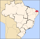
Location in Rio Grande do Norte state
(2020 [1])
Cerro Corá is a municipality (município) in the Brazilian state of Rio Grande do Norte. As of 2020 IBGE, it reported an estimated population of 11,181 inhabitants. The municipality covers a total area of 394 km2.
References
- ^ IBGE 2020
- v
- t
- e

Capital: Natal
Agreste Potiguar
| Agreste Potiguar |
|
|---|---|
| Baixa Verde | |
| Borborema Potiguar |
Central Potiguar
| Angicos | |
|---|---|
| Macau | |
| Seridó Ocidental | |
| Seridó Oriental | |
| Serra de Santana |
Leste Potiguar
| Litoral Nordeste | |
|---|---|
| Litoral Sul | |
| Macaíba | |
| Natal |
Oeste Potiguar
| Chapada do Apodi | |
|---|---|
| Medio Oeste | |
| Mossoró | |
| Pau dos Ferros | |
| Serra de São Miguel | |
| Umarizal | |
| Vale do Açu |
 | This Rio Grande do Norte, Brazil location article is a stub. You can help Wikipedia by expanding it. |
- v
- t
- e


