El Salto, Durango
City in the Mexican state of Durango
Municipal Seat and city in Durango, Mexico
23°46′56.424″N 105°21′30.5958″W / 23.78234000°N 105.358498833°W / 23.78234000; -105.358498833 Mexico
 (2015)
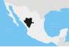
El Salto is a city and seat of the municipality of Pueblo Nuevo in the southwestern part of the Mexican state of Durango. In 2015, the town had a total population of 24,241,[1] Situated on a pine-forested plateau about 2,580 meters (8,464 feet) above sea level in the Sierra Madre mountain range, the town is home to a large lumber industry. It also has a military base. The surrounding municipality has a population of 50,417 and an area of 6,178.3 km² (2,385.45 sq mi).[2]
Geography
Climate
El Salto has a subtropical highland climate (Köppen Cwb). Thanks to its location in the high plateau of the Sierra Madre Occidental it receives abundant rain during the summer months; enough for it to avoid the semi-arid (BSk) classification found further inland. Due to its location the town experiences mild but rainy summers, and relatively dry and chilly winters with freezing night temperatures. Winter months witness the occasional snow storm.
| Month | Jan | Feb | Mar | Apr | May | Jun | Jul | Aug | Sep | Oct | Nov | Dec | Year |
|---|---|---|---|---|---|---|---|---|---|---|---|---|---|
| Record high °C (°F) | 24.0 (75.2) | 30.0 (86.0) | 28.0 (82.4) | 30.0 (86.0) | 33.0 (91.4) | 32.0 (89.6) | 30.0 (86.0) | 28.0 (82.4) | 27.0 (80.6) | 27.0 (80.6) | 27.0 (80.6) | 25.0 (77.0) | 33.0 (91.4) |
| Mean daily maximum °C (°F) | 16.2 (61.2) | 17.5 (63.5) | 19.8 (67.6) | 21.9 (71.4) | 24.3 (75.7) | 25.2 (77.4) | 23.1 (73.6) | 22.6 (72.7) | 21.9 (71.4) | 21.3 (70.3) | 19.4 (66.9) | 16.9 (62.4) | 20.8 (69.4) |
| Daily mean °C (°F) | 5.9 (42.6) | 6.8 (44.2) | 8.4 (47.1) | 10.5 (50.9) | 13.2 (55.8) | 16.0 (60.8) | 16.1 (61.0) | 15.7 (60.3) | 15.0 (59.0) | 12.1 (53.8) | 8.9 (48.0) | 6.8 (44.2) | 11.3 (52.3) |
| Mean daily minimum °C (°F) | −4.4 (24.1) | −4.0 (24.8) | −3.1 (26.4) | −0.9 (30.4) | 2.0 (35.6) | 6.7 (44.1) | 9.1 (48.4) | 8.9 (48.0) | 8.0 (46.4) | 2.9 (37.2) | −1.5 (29.3) | −3.3 (26.1) | 1.7 (35.1) |
| Record low °C (°F) | −14.0 (6.8) | −14.0 (6.8) | −13.0 (8.6) | −12.0 (10.4) | −10.0 (14.0) | −6.0 (21.2) | 1.0 (33.8) | 2.0 (35.6) | −1.0 (30.2) | −7.0 (19.4) | −10.0 (14.0) | −14.0 (6.8) | −14.0 (6.8) |
| Average precipitation mm (inches) | 64.9 (2.56) | 19.2 (0.76) | 13.9 (0.55) | 15.9 (0.63) | 36.5 (1.44) | 155.9 (6.14) | 222.9 (8.78) | 189.4 (7.46) | 136.2 (5.36) | 68.8 (2.71) | 43.5 (1.71) | 52.0 (2.05) | 1,019.1 (40.15) |
| Average precipitation days (≥ 0.1 mm) | 4.1 | 2.0 | 1.6 | 1.8 | 3.9 | 15.1 | 22.4 | 21.0 | 14.6 | 6.6 | 2.9 | 3.7 | 99.7 |
| Source: Servicio Meteorológico National[3] | |||||||||||||
References
- ^ "Pueblo Nuevo". Catálogo de Localidades. Secretaría de Desarrollo Social (SEDESOL). Retrieved 23 April 2014.
- ^ "Número de habitantes. Durango".
- ^ "Normales Climatológicas 1951-2010". Servicio Meteorológico Nacional. Retrieved November 8, 2020.
- Link to tables of population data from Census of 2005 INEGI: Instituto Nacional de Estadística, Geografía e Informática
- Durango Enciclopedia de los Municipios de México
- v
- t
- e
 State of Durango
Durango (capital)
and
(municipal seats)
- Canatlán (Ciudad Canatlán)
- Canelas (Canelas)
- Coneto de Comfort (Coneto de Comonfort)
- Cuencamé (Cuencamé)
- Durango (Victoria de Durango)
- El Oro (Santa María del Oro)
- General Simón Bolívar (General Simón Bolívar)
- Gómez Palacio (Gómez Palacio)
- Guadalupe Victoria (Ciudad Guadalupe Victoria)
- Guanaceví (Guanaceví)
- Hidalgo (Villa Hidalgo)
- Indé (Indé)
- Lerdo (Ciudad Lerdo)
- Mapimí (Mapimí)
- Mezquital (San Francisco del Mezquital)
- Nazas (Nazas)
- Nombre de Dios (Nombre de Dios)
- Nuevo Ideal (Nuevo Ideal)
- Ocampo (Villa Ocampo)
- Otáez (Otáez)
- Pánuco de Coronado (Francisco I. Madero)
- Peñón Blanco (Peñón Blanco)
- Poanas (Villa Unión)
- Pueblo Nuevo (El Salto)
- Rodeo (Rodeo)
- San Bernardo (San Bernardo)
- San Dimas (Tayoltita)
- San Juan de Guadalupe (San Juan de Guadalupe)
- San Juan del Río (San Juan del Río)
- San Luis del Cordero (San Luis del Cordero)
- San Pedro del Gallo (San Pedro del Gallo)
- Santa Clara (Santa Clara)
- Santiago Papasquiaro (Santiago Papasquiaro)
- Súchil (Súchil)
- Tamazula (Tamazula de Victoria)
- Tepehuanes (Santa Catarina de Tepehuanes)
- Tlahualilo (Tlahualilo de Zaragoza)
- Topia (Topia)
- Vicente Guerrero (Vicente Guerrero)


 El_Salto,_Durango