List of waterfalls in Idaho

Map all coordinates using OpenStreetMap
Download coordinates as:
- KML
- GPX (all coordinates)
- GPX (primary coordinates)
- GPX (secondary coordinates)
There are at least 63 named waterfalls in Idaho as listed in the Geographic Names Information System by the U.S. Geological Survey.
- Albeni Falls, Bonner County, Idaho, 48°10′5″N 117°00′05″W / 48.16806°N 117.00139°W / 48.16806; -117.00139 (Albeni Falls), el. 2,064 feet (629 m) [1]
- Auger Falls, Twin Falls County, Idaho, 42°37′5″N 114°31′38″W / 42.61806°N 114.52722°W / 42.61806; -114.52722 (Auger Falls), el. 3,025 feet (922 m) [2]
- Baron Creek Falls, Boise County, Idaho, 44°06′5″N 115°02′06″W / 44.10139°N 115.03500°W / 44.10139; -115.03500 (Baron Creek Falls), el. 7,595 feet (2,315 m) [3]
- Bear Creek Falls, Adams County, Idaho, 44°58′5″N 116°42′07″W / 44.96806°N 116.70194°W / 44.96806; -116.70194 (Bear Creek Falls), el. 4,055 feet (1,236 m) [4]
- Big Drops, Lincoln County, Idaho, 42°57′5″N 114°23′38″W / 42.95139°N 114.39389°W / 42.95139; -114.39389 (Big Drops), el. 3,983 feet (1,214 m) [5]
- Big Falls, Boise County, Idaho, 44°03′5″N 115°43′23″W / 44.05139°N 115.72306°W / 44.05139; -115.72306 (Big Falls), el. 3,497 feet (1,066 m) [6]
- Bridal Veil Falls, Custer County, Idaho, 44°12′5″N 115°06′24″W / 44.20139°N 115.10667°W / 44.20139; -115.10667 (Bridal Veil Falls), el. 7,254 feet (2,211 m) [7]
- Bull Run Creek Falls, Clearwater County, Idaho, 46°44′5″N 116°11′45″W / 46.73472°N 116.19583°W / 46.73472; -116.19583 (Bull Run Creek Falls), el. 2,477 feet (755 m) [8]
- Camel Falls, Owyhee County, Idaho, 42°32′5″N 116°37′23″W / 42.53472°N 116.62306°W / 42.53472; -116.62306 (Camel Falls), el. 5,449 feet (1,661 m) [9]
- Caribou Falls, Boundary County, Idaho, 48°49′5″N 116°46′45″W / 48.81806°N 116.77917°W / 48.81806; -116.77917 (Caribou Falls), el. 3,442 feet (1,049 m) [10]
- Char Falls, Bonner County, Idaho, 48°21′5″N 116°10′15″W / 48.35139°N 116.17083°W / 48.35139; -116.17083 (Char Falls), el. 4,134 feet (1,260 m) [11]
- Copper Falls, Boundary County, Idaho, 48°58′5″N 116°08′32″W / 48.96806°N 116.14222°W / 48.96806; -116.14222 (Copper Falls), el. 3,415 feet (1,041 m) [12]
- Crane Falls (historical), Elmore County, Idaho, 42°58′5″N 115°49′50″W / 42.96806°N 115.83056°W / 42.96806; -115.83056 (Crane Falls (historical)), el. 2,457 feet (749 m) [13]
- Dagger Falls, Valley County, Idaho, 44°31′5″N 115°17′09″W / 44.51806°N 115.28583°W / 44.51806; -115.28583 (Dagger Falls), el. 5,679 feet (1,731 m) [14]
- Deadman Falls, Elmore County, Idaho, 42°53′5″N 115°21′06″W / 42.88472°N 115.35167°W / 42.88472; -115.35167 (Deadman Falls), el. 2,907 feet (886 m) [15]
- Devils Washboard Falls, Gooding County, Idaho, 42°40′5″N 114°46′43″W / 42.66806°N 114.77861°W / 42.66806; -114.77861 (Devils Washboard Falls), el. 2,959 feet (902 m) [16]
- Devlin Falls, Lemhi County, Idaho, 45°13′5″N 114°05′52″W / 45.21806°N 114.09778°W / 45.21806; -114.09778 (Devlin Falls), el. 6,788 feet (2,069 m) [17]
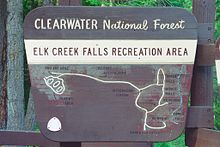
- Elk Creek Falls, Clearwater County, Idaho, 46°44′5″N 116°10′27″W / 46.73472°N 116.17417°W / 46.73472; -116.17417 (Elk Creek Falls), el. 2,562 feet (781 m) [18]
- Fall Creek Falls, Bonneville County, Idaho, 43°26′5″N 111°22′38″W / 43.43472°N 111.37722°W / 43.43472; -111.37722 (Fall Creek Falls), el. 5,266 feet (1,605 m) [19]
- Fern Falls, Boise County, Idaho, 44°02′5″N 115°05′22″W / 44.03472°N 115.08944°W / 44.03472; -115.08944 (Fern Falls), el. 6,401 feet (1,951 m) [20]
- Fern Falls, Shoshone County, Idaho, 47°45′5″N 116°06′18″W / 47.75139°N 116.10500°W / 47.75139; -116.10500 (Fern Falls), el. 3,228 feet (984 m) [21]
- Goat Falls, Custer County, Idaho, 44°10′5″N 115°01′04″W / 44.16806°N 115.01778°W / 44.16806; -115.01778 (Goat Falls), el. 8,104 feet (2,470 m) [22]
- Grouse Creek Falls, Bonner County, Idaho, 48°27′5″N 116°20′20″W / 48.45139°N 116.33889°W / 48.45139; -116.33889 (Grouse Creek Falls), el. 2,687 feet (819 m) [23]
- Hazard Falls, Idaho County, Idaho, 45°12′5″N 116°15′23″W / 45.20139°N 116.25639°W / 45.20139; -116.25639 (Hazard Falls), el. 4,787 feet (1,459 m) [24]
- Jump Creek Falls, Owyhee County, Idaho, 43°28′5″N 116°55′32″W / 43.46806°N 116.92556°W / 43.46806; -116.92556 (Jump Creek Falls), el. 2,687 feet (819 m) [25]
- Lady Face Falls, Custer County, Idaho, 44°13′5″N 115°05′45″W / 44.21806°N 115.09583°W / 44.21806; -115.09583 (Lady Face Falls), el. 6,637 feet (2,023 m) [26]
- Little Drops, Lincoln County, Idaho, 42°58′5″N 114°25′16″W / 42.96806°N 114.42111°W / 42.96806; -114.42111 (Little Drops), el. 3,973 feet (1,211 m) [27]
- Little Falls, Boise County, Idaho, 44°04′5″N 115°45′45″W / 44.06806°N 115.76250°W / 44.06806; -115.76250 (Little Falls), el. 3,409 feet (1,039 m) [28]
- Lost Creek Falls, Adams County, Idaho, 44°55′5″N 116°27′11″W / 44.91806°N 116.45306°W / 44.91806; -116.45306 (Lost Creek Falls), el. 4,393 feet (1,339 m) [29]
- Lower Mesa Falls, Fremont County, Idaho, 44°10′5″N 111°19′11″W / 44.16806°N 111.31972°W / 44.16806; -111.31972 (Lower Mesa Falls), el. 5,518 feet (1,682 m) [30]
- Lower Salmon Falls, Gooding County, Idaho, 42°50′5″N 114°54′15″W / 42.83472°N 114.90417°W / 42.83472; -114.90417 (Lower Salmon Falls), el. 2,657 feet (810 m) [31]
- Mallard Creek Falls, Idaho County, Idaho, 45°33′5″N 115°17′53″W / 45.55139°N 115.29806°W / 45.55139; -115.29806 (Mallard Creek Falls), el. 4,757 feet (1,450 m) [32]
- McAbee Falls, Bonner County, Idaho, 48°17′5″N 116°52′19″W / 48.28472°N 116.87194°W / 48.28472; -116.87194 (McAbee Falls), el. 2,192 feet (668 m) [33]
- Mission Falls, Bonner County, Idaho, 48°25′5″N 116°55′44″W / 48.41806°N 116.92889°W / 48.41806; -116.92889 (Mission Falls), el. 2,323 feet (708 m) [34]
- Moyie Falls, Boundary County, Idaho, 48°43′5″N 116°10′32″W / 48.71806°N 116.17556°W / 48.71806; -116.17556 (Moyie Falls), el. 1,936 feet (590 m) [35]
- Napias Creek Falls, Lemhi County, Idaho, 45°08′5″N 114°12′04″W / 45.13472°N 114.20111°W / 45.13472; -114.20111 (Napias Creek Falls), el. 5,059 feet (1,542 m) [36]
- Patsy Ann Falls, Idaho County, Idaho, 45°57′5″N 114°27′29″W / 45.95139°N 114.45806°W / 45.95139; -114.45806 (Patsy Ann Falls), el. 5,400 feet (1,600 m) [37]
- Perrine Coulee Falls, Twin Falls County, Idaho, 42°35′5″N 114°28′21″W / 42.58472°N 114.47250°W / 42.58472; -114.47250 (Perrine Coulee Falls), el. 3,573 feet (1,089 m) [38]
- Phantom Falls, Cassia County, Idaho, 42°05′5″N 114°07′54″W / 42.08472°N 114.13167°W / 42.08472; -114.13167 (Phantom Falls), el. 6,375 feet (1,943 m) [39]
- Pillar Falls, Twin Falls County, Idaho, 42°35′5″N 114°25′52″W / 42.58472°N 114.43111°W / 42.58472; -114.43111 (Pillar Falls), el. 3,140 feet (960 m) [40]
- Rambiker Falls, Shoshone County, Idaho, 47°01′5″N 115°05′17″W / 47.01806°N 115.08806°W / 47.01806; -115.08806 (Rambiker Falls), el. 6,250 feet (1,900 m) [41]
- Ross Falls, Twin Falls County, Idaho, 42°12′5″N 114°17′23″W / 42.20139°N 114.28972°W / 42.20139; -114.28972 (Ross Falls), el. 6,407 feet (1,953 m) [42]
- Rush Falls, Washington County, Idaho, 44°43′5″N 116°41′24″W / 44.71806°N 116.69000°W / 44.71806; -116.69000 (Rush Falls), el. 6,073 feet (1,851 m) [43]
- Salmon Falls, Idaho County, Idaho, 45°29′5″N 114°59′56″W / 45.48472°N 114.99889°W / 45.48472; -114.99889 (Salmon Falls), el. 2,677 feet (816 m) [44]
- Salmon Falls, Twin Falls County, Idaho, 42°46′5″N 114°53′50″W / 42.76806°N 114.89722°W / 42.76806; -114.89722 (Salmon Falls), el. 2,871 feet (875 m) [45]
- Selway Falls, Idaho County, Idaho, 46°03′5″N 115°18′26″W / 46.05139°N 115.30722°W / 46.05139; -115.30722 (Selway Falls), el. 1,706 feet (520 m) [46]
- Shadow Falls, Shoshone County, Idaho, 47°45′5″N 116°06′25″W / 47.75139°N 116.10694°W / 47.75139; -116.10694 (Shadow Falls), el. 3,350 feet (1,020 m) [47]
- Sheep Falls, Fremont County, Idaho, 44°04′5″N 111°05′31″W / 44.06806°N 111.09194°W / 44.06806; -111.09194 (Sheep Falls), el. 5,909 feet (1,801 m) [48]
- Sheep Falls, Fremont County, Idaho, 44°12′5″N 111°23′38″W / 44.20139°N 111.39389°W / 44.20139; -111.39389 (Sheep Falls), el. 5,820 feet (1,770 m) [49]
- Shoestring Falls, Idaho County, Idaho, 46°16′5″N 115°23′25″W / 46.26806°N 115.39028°W / 46.26806; -115.39028 (Shoestring Falls), el. 1,913 feet (583 m) [50]
- Shoshone Falls, Twin Falls County, Idaho, 42°35′5″N 114°24′03″W / 42.58472°N 114.40083°W / 42.58472; -114.40083 (Shoshone Falls), el. 3,255 feet (992 m) [51]
- Smith Falls, Boise County, Idaho, 44°00′5″N 115°02′26″W / 44.00139°N 115.04056°W / 44.00139; -115.04056 (Smith Falls), el. 7,060 feet (2,150 m) [52]
- Smith Falls, Boundary County, Idaho, 48°57′5″N 116°33′29″W / 48.95139°N 116.55806°W / 48.95139; -116.55806 (Smith Falls), el. 1,909 feet (582 m) [53]
- Snow Creek Falls, Boundary County, Idaho, 48°40′5″N 116°25′46″W / 48.66806°N 116.42944°W / 48.66806; -116.42944 (Snow Creek Falls), el. 2,293 feet (699 m) [54]
- The Falls, Caribou County, Idaho, 42°45′5″N 111°06′46″W / 42.75139°N 111.11278°W / 42.75139; -111.11278 (The Falls), el. 7,047 feet (2,148 m) [55]
- The Falls, Owyhee County, Idaho, 42°31′5″N 116°11′17″W / 42.51806°N 116.18806°W / 42.51806; -116.18806 (The Falls), el. 5,463 feet (1,665 m) [56]
- Torrelle Falls, Bonner County, Idaho, 48°17′5″N 116°57′31″W / 48.28472°N 116.95861°W / 48.28472; -116.95861 (Torrelle Falls), el. 2,287 feet (697 m) [57]
- Twin Falls, Jerome County, Idaho, 42°35′5″N 114°21′14″W / 42.58472°N 114.35389°W / 42.58472; -114.35389 (Twin Falls), el. 3,517 feet (1,072 m) [58]
- Upper Mesa Falls, Fremont County, Idaho, 44°11′5″N 111°19′48″W / 44.18472°N 111.33000°W / 44.18472; -111.33000 (Upper Mesa Falls), el. 5,613 feet (1,711 m) [59]
- Upper Priest Falls, Boundary County, Idaho, 48°59′5″N 116°56′27″W / 48.98472°N 116.94083°W / 48.98472; -116.94083 (Upper Priest Falls), el. 3,432 feet (1,046 m) [60]
- Upper Salmon Falls, Twin Falls County, Idaho, 42°46′5″N 114°53′50″W / 42.76806°N 114.89722°W / 42.76806; -114.89722 (Upper Salmon Falls), el. 2,871 feet (875 m) [61]
- Wildhorse Falls, Adams County, Idaho, 44°50′5″N 116°49′04″W / 44.83472°N 116.81778°W / 44.83472; -116.81778 (Wildhorse Falls), el. 2,795 feet (852 m) [62]
Notes
- ^ "Albeni Falls". Geographic Names Information System. United States Geological Survey, United States Department of the Interior.
- ^ "Auger Falls". Geographic Names Information System. United States Geological Survey, United States Department of the Interior.
- ^ "Baron Creek Falls". Geographic Names Information System. United States Geological Survey, United States Department of the Interior.
- ^ "Bear Creek Falls". Geographic Names Information System. United States Geological Survey, United States Department of the Interior.
- ^ "Big Drops". Geographic Names Information System. United States Geological Survey, United States Department of the Interior.
- ^ "Big Falls". Geographic Names Information System. United States Geological Survey, United States Department of the Interior.
- ^ "Bridal Veil Falls". Geographic Names Information System. United States Geological Survey, United States Department of the Interior.
- ^ "Bull Run Creek Falls". Geographic Names Information System. United States Geological Survey, United States Department of the Interior.
- ^ "Camel Falls". Geographic Names Information System. United States Geological Survey, United States Department of the Interior.
- ^ "Caribou Falls". Geographic Names Information System. United States Geological Survey, United States Department of the Interior.
- ^ "Char Falls". Geographic Names Information System. United States Geological Survey, United States Department of the Interior.
- ^ "Copper Falls". Geographic Names Information System. United States Geological Survey, United States Department of the Interior.
- ^ "Crane Falls (historical)". Geographic Names Information System. United States Geological Survey, United States Department of the Interior.
- ^ "Dagger Falls". Geographic Names Information System. United States Geological Survey, United States Department of the Interior.
- ^ "Deadman Falls". Geographic Names Information System. United States Geological Survey, United States Department of the Interior.
- ^ "Devils Washboard Falls". Geographic Names Information System. United States Geological Survey, United States Department of the Interior.
- ^ "Devlin Falls". Geographic Names Information System. United States Geological Survey, United States Department of the Interior.
- ^ "Elk Creek Falls". Geographic Names Information System. United States Geological Survey, United States Department of the Interior.
- ^ "Fall Creek Falls". Geographic Names Information System. United States Geological Survey, United States Department of the Interior.
- ^ "Fern Falls". Geographic Names Information System. United States Geological Survey, United States Department of the Interior.
- ^ "Fern Falls". Geographic Names Information System. United States Geological Survey, United States Department of the Interior.
- ^ "Goat Falls". Geographic Names Information System. United States Geological Survey, United States Department of the Interior.
- ^ "Grouse Creek Falls". Geographic Names Information System. United States Geological Survey, United States Department of the Interior.
- ^ "Hazard Falls". Geographic Names Information System. United States Geological Survey, United States Department of the Interior.
- ^ "Jump Creek Falls". Geographic Names Information System. United States Geological Survey, United States Department of the Interior.
- ^ "Lady Face Falls". Geographic Names Information System. United States Geological Survey, United States Department of the Interior.
- ^ "Little Drops". Geographic Names Information System. United States Geological Survey, United States Department of the Interior.
- ^ "Little Falls". Geographic Names Information System. United States Geological Survey, United States Department of the Interior.
- ^ "Lost Creek Falls". Geographic Names Information System. United States Geological Survey, United States Department of the Interior.
- ^ "Lower Mesa Falls". Geographic Names Information System. United States Geological Survey, United States Department of the Interior.
- ^ "Lower Salmon Falls". Geographic Names Information System. United States Geological Survey, United States Department of the Interior.
- ^ "Mallard Creek Falls". Geographic Names Information System. United States Geological Survey, United States Department of the Interior.
- ^ "McAbee Falls". Geographic Names Information System. United States Geological Survey, United States Department of the Interior.
- ^ "Mission Falls". Geographic Names Information System. United States Geological Survey, United States Department of the Interior.
- ^ "Moyie Falls". Geographic Names Information System. United States Geological Survey, United States Department of the Interior.
- ^ "Napias Creek Falls". Geographic Names Information System. United States Geological Survey, United States Department of the Interior.
- ^ "Patsy Ann Falls". Geographic Names Information System. United States Geological Survey, United States Department of the Interior.
- ^ "Perrine Coulee Falls". Geographic Names Information System. United States Geological Survey, United States Department of the Interior.
- ^ "Phantom Falls". Geographic Names Information System. United States Geological Survey, United States Department of the Interior.
- ^ "Pillar Falls". Geographic Names Information System. United States Geological Survey, United States Department of the Interior.
- ^ "Rambiker Falls". Geographic Names Information System. United States Geological Survey, United States Department of the Interior.
- ^ "Ross Falls". Geographic Names Information System. United States Geological Survey, United States Department of the Interior.
- ^ "Rush Falls". Geographic Names Information System. United States Geological Survey, United States Department of the Interior.
- ^ "Salmon Falls". Geographic Names Information System. United States Geological Survey, United States Department of the Interior.
- ^ "Salmon Falls". Geographic Names Information System. United States Geological Survey, United States Department of the Interior.
- ^ "Selway Falls". Geographic Names Information System. United States Geological Survey, United States Department of the Interior.
- ^ "Shadow Falls". Geographic Names Information System. United States Geological Survey, United States Department of the Interior.
- ^ "Sheep Falls". Geographic Names Information System. United States Geological Survey, United States Department of the Interior.
- ^ "Sheep Falls". Geographic Names Information System. United States Geological Survey, United States Department of the Interior.
- ^ "Shoestring Falls". Geographic Names Information System. United States Geological Survey, United States Department of the Interior.
- ^ "Shoshone Falls". Geographic Names Information System. United States Geological Survey, United States Department of the Interior.
- ^ "Smith Falls". Geographic Names Information System. United States Geological Survey, United States Department of the Interior.
- ^ "Smith Falls". Geographic Names Information System. United States Geological Survey, United States Department of the Interior.
- ^ "Snow Creek Falls". Geographic Names Information System. United States Geological Survey, United States Department of the Interior.
- ^ "The Falls". Geographic Names Information System. United States Geological Survey, United States Department of the Interior.
- ^ "The Falls". Geographic Names Information System. United States Geological Survey, United States Department of the Interior.
- ^ "Torrelle Falls". Geographic Names Information System. United States Geological Survey, United States Department of the Interior.
- ^ "Twin Falls". Geographic Names Information System. United States Geological Survey, United States Department of the Interior.
- ^ "Upper Mesa Falls". Geographic Names Information System. United States Geological Survey, United States Department of the Interior.
- ^ "Upper Priest Falls". Geographic Names Information System. United States Geological Survey, United States Department of the Interior.
- ^ "Upper Salmon Falls". Geographic Names Information System. United States Geological Survey, United States Department of the Interior.
- ^ "Wildhorse Falls". Geographic Names Information System. United States Geological Survey, United States Department of the Interior.
See also
 Idaho portal
 Geography portal
 Lakes portal
 Rivers portal


- List of Idaho rivers
- List of longest streams of Idaho
- Lost streams of Idaho
- Snake River Plain (ecoregion)
- Snake River Plain
- List of lakes of Idaho
- v
- t
- e
State of Idaho
Boise (capital)
- Index
- Geography
- Government
- Delegations
- Governors
- History
- Images
- People
- Symbols
- Tourist attractions
cities
cities
- Ada
- Adams
- Bannock
- Bear Lake
- Benewah
- Bingham
- Blaine
- Boise
- Bonner
- Bonneville
- Boundary
- Butte
- Camas
- Canyon
- Caribou
- Cassia
- Clark
- Clearwater
- Custer
- Elmore
- Franklin
- Fremont
- Gem
- Gooding
- Idaho
- Jefferson
- Jerome
- Kootenai
- Latah
- Lemhi
- Lewis
- Lincoln
- Madison
- Minidoka
- Nez Perce
- Oneida
- Owyhee
- Payette
- Power
- Shoshone
- Teton
- Twin Falls
- Valley
- Washington
 Idaho portal


