Melito Irpino
You can help expand this article with text translated from the corresponding article in Italian. (January 2022) Click [show] for important translation instructions.
- Machine translation, like DeepL or Google Translate, is a useful starting point for translations, but translators must revise errors as necessary and confirm that the translation is accurate, rather than simply copy-pasting machine-translated text into the English Wikipedia.
- Do not translate text that appears unreliable or low-quality. If possible, verify the text with references provided in the foreign-language article.
- You must provide copyright attribution in the edit summary accompanying your translation by providing an interlanguage link to the source of your translation. A model attribution edit summary is
Content in this edit is translated from the existing Italian Wikipedia article at [[:it:Melito Irpino]]; see its history for attribution. - You may also add the template
{{Translated|it|Melito Irpino}}to the talk page. - For more guidance, see Wikipedia:Translation.
Comune in Campania, Italy
Melito Irpino | |
|---|---|
Comune | |
| Comune di Melito Irpino | |
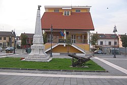 Melito town hall | |
 Melito Irpino within the Province of Avellino | |
Location of Melito Irpino  | |
41°6′15″N 15°3′12″E / 41.10417°N 15.05333°E / 41.10417; 15.05333 | |
| Country | Italy |
| Region | Campania |
| Province | Avellino (AV) |
| Frazioni | Cozza, Fontana del Bosco, Incoronata |
| Area | |
| • Total | 20.68 km2 (7.98 sq mi) |
| Elevation | 461 m (1,512 ft) |
| Population (31 December 2017)[3] | |
| • Total | 1,927 |
| • Density | 93/km2 (240/sq mi) |
| Demonym | Melitese |
| Time zone | UTC+1 (CET) |
| • Summer (DST) | UTC+2 (CEST) |
| Postal code | 83030 |
| Dialing code | 0825 |
| Patron saint | Saint Giles |
| Saint day | 1 September |
| Website | Official website |
Melito Irpino (Irpino: Militë) is a town and comune in the province of Avellino, in the Campania region of south-western Italy.
History
The remains of the ancient Melito were found in 1880. According to some theories, it could be a suburban village belonging to Aeclanum, but the prevailing theory suggests that it was the ancient village of Melae (or Melas). In Ab Urbe Condita (book XXIV, chapter X), Titus Livius wrote that Melae was destroyed in 215 BC by the troops of Claudius Marcellus and Quintus Fabius, during the Second Punic War.[4]
Geography
The municipality is located in the northern area of its province, next to that of Benevento. Crossed by the river Ufita, it borders with Apice, Ariano Irpino, Bonito and Grottaminarda.[5] Its hamlets (frazioni) are the small villages of Cozza, Fontana del Bosco and Incoronata.
The town, included in the Roman Catholic Diocese of Ariano Irpino-Lacedonia, is 5 km far from Grottaminarda, 9 from Ariano Irpino, 30 from Benevento and 48 from Avellino. Nearest motorway exit is located in Grottaminarda, on the A16 Naples-Bari.
Main sights


- The medieval old town, damaged by the 1962 Irpinia earthquake and then abandoned.[4][6]
- The medieval castle in the old town.[7]
People
- Raffaele Minichiello [it] (b. 1949), the first transatlantic hijacker
- Tonino Sorrentino (b. 1985), footballer
References
- ^ "Superficie di Comuni Province e Regioni italiane al 9 ottobre 2011". Italian National Institute of Statistics. Retrieved 16 March 2019.
- ^ "Melito Irpino". Tuttitalia (in Italian).
- ^ (in Italian) Source: Istat 2011
- ^ a b History of Melito Irpino (municipal website)
- ^ 41100
(x a j h)Melito Irpino on OpenStreetMap - ^ (in Italian) Melito Irpino on paesifantasma.it (Italian ghost towns website)
- ^ (in Italian) The Castle of Melito Irpino on museodeicastelli.it
External links
Wikimedia Commons has media related to Melito Irpino.
- Official website (in Italian)
- Melito Irpino on comuni-italiani.it (in Italian)
- v
- t
- e
- Aiello del Sabato
- Altavilla Irpina
- Andretta
- Aquilonia
- Ariano Irpino
- Atripalda
- Avella
- Avellino
- Bagnoli Irpino
- Baiano
- Bisaccia
- Bonito
- Cairano
- Calabritto
- Calitri
- Candida
- Caposele
- Capriglia Irpina
- Carife
- Casalbore
- Cassano Irpino
- Castel Baronia
- Castelfranci
- Castelvetere sul Calore
- Cervinara
- Cesinali
- Chianche
- Chiusano di San Domenico
- Contrada
- Conza della Campania
- Domicella
- Flumeri
- Fontanarosa
- Forino
- Frigento
- Gesualdo
- Greci
- Grottaminarda
- Grottolella
- Guardia Lombardi
- Lacedonia
- Lapio
- Lauro
- Lioni
- Luogosano
- Manocalzati
- Marzano di Nola
- Melito Irpino
- Mercogliano
- Mirabella Eclano
- Montaguto
- Montecalvo Irpino
- Montefalcione
- Monteforte Irpino
- Montefredane
- Montefusco
- Montella
- Montemarano
- Montemiletto
- Monteverde
- Montoro
- Morra De Sanctis
- Moschiano
- Mugnano del Cardinale
- Nusco
- Ospedaletto d'Alpinolo
- Pago del Vallo di Lauro
- Parolise
- Paternopoli
- Petruro Irpino
- Pietradefusi
- Pietrastornina
- Prata di Principato Ultra
- Pratola Serra
- Quadrelle
- Quindici
- Rocca San Felice
- Roccabascerana
- Rotondi
- Salza Irpina
- San Mango sul Calore
- San Martino Valle Caudina
- San Michele di Serino
- San Nicola Baronia
- San Potito Ultra
- San Sossio Baronia
- Santa Lucia di Serino
- Santa Paolina
- Sant'Andrea di Conza
- Sant'Angelo a Scala
- Sant'Angelo all'Esca
- Sant'Angelo dei Lombardi
- Santo Stefano del Sole
- Savignano Irpino
- Scampitella
- Senerchia
- Serino
- Sirignano
- Solofra
- Sorbo Serpico
- Sperone
- Sturno
- Summonte
- Taurano
- Taurasi
- Teora
- Torella dei Lombardi
- Torre Le Nocelle
- Torrioni
- Trevico
- Tufo
- Vallata
- Vallesaccarda
- Venticano
- Villamaina
- Villanova del Battista
- Volturara Irpina
- Zungoli

 | This Campanian location article is a stub. You can help Wikipedia by expanding it. |
- v
- t
- e


