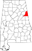
National Register of Historic Places listings in Cleburne County, Alabama

This is a list of the National Register of Historic Places listings in Cleburne County, Alabama.
This is intended to be a complete list of the properties and districts on the National Register of Historic Places in Cleburne County, Alabama, United States. Latitude and longitude coordinates are provided for many National Register properties and districts; these locations may be seen together in a Google map.[1]
There are four properties and districts listed on the National Register in the county.
This National Park Service list is complete through NPS recent listings posted September 13, 2024.[2]
Map all coordinates using OpenStreetMap
Download coordinates as:
- KML
- GPX (all coordinates)
- GPX (primary coordinates)
- GPX (secondary coordinates)
| [3] | Name on the Register | Image | Date listed[4] | Location | City or town | Description |
|---|---|---|---|---|---|---|
| 1 | Cleburne County Courthouse |  | June 22, 1976 (#76000317) | Vickory St. 33°38′58″N 85°35′17″W / 33.649444°N 85.588056°W / 33.649444; -85.588056 (Cleburne County Courthouse) | Heflin | |
| 2 | Cleburne County High School | Upload image | August 13, 2018 (#100002763) | 911 Willoughby St. 33°38′40″N 85°35′08″W / 33.644471°N 85.585527°W / 33.644471; -85.585527 (Cleburne County High School) | Heflin | The old county high school building. |
| 3 | John Morgan House |  | August 5, 1993 (#93000762) | 321 Ross St. 33°38′51″N 85°35′13″W / 33.6475°N 85.586944°W / 33.6475; -85.586944 (John Morgan House) | Heflin | |
| 4 | Shoal Creek Church |  | December 4, 1974 (#74000404) | On Forest Service Road 533 in the Talladega National Forest, 4 miles (6.4 km) northwest of Edwardsville 33°46′32″N 85°33′50″W / 33.775556°N 85.563889°W / 33.775556; -85.563889 (Shoal Creek Church) | Edwardsville |
See also
Wikimedia Commons has media related to National Register of Historic Places in Cleburne County, Alabama.
- List of National Historic Landmarks in Alabama
- National Register of Historic Places listings in Alabama
References
- ^ The latitude and longitude information provided in this table was derived originally from the National Register Information System, which has been found to be fairly accurate for about 99% of listings. Some locations in this table may have been corrected to current GPS standards.
- ^ National Park Service, United States Department of the Interior, "National Register of Historic Places: Weekly List Actions", retrieved September 13, 2024.
- ^ Numbers represent an alphabetical ordering by significant words. Various colorings, defined here, differentiate National Historic Landmarks and historic districts from other NRHP buildings, structures, sites or objects.
- ^ The eight-digit number below each date is the number assigned to each location in the National Register Information System database, which can be viewed by clicking the number.
- v
- t
- e
by county
- Autauga
- Baldwin
- Barbour
- Bibb
- Blount
- Bullock
- Butler
- Calhoun
- Chambers
- Cherokee
- Chilton
- Choctaw
- Clarke
- Clay
- Cleburne
- Coffee
- Colbert
- Conecuh
- Coosa
- Covington
- Crenshaw
- Cullman
- Dale
- Dallas
- DeKalb
- Elmore
- Escambia
- Etowah
- Fayette
- Franklin
- Geneva
- Greene
- Hale
- Henry
- Houston
- Jackson
- Jefferson
- Lamar
- Lauderdale
- Lawrence
- Lee
- Limestone
- Lowndes
- Macon
- Madison
- Marengo
- Marion
- Marshall
- Mobile
- Monroe
- Montgomery
- Morgan
- Perry
- Pickens
- Pike
- Randolph
- Russell
- St. Clair
- Shelby
- Sumter
- Talladega
- Tallapoosa
- Tuscaloosa
- Walker
- Washington
- Wilcox
- Winston