Osmaniye District
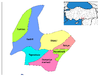
District of Osmaniye Province, Turkey
District in Osmaniye, Turkey
37°05′N 36°15′E / 37.083°N 36.250°E / 37.083; 36.250 (2022)
Osmaniye District (also: Merkez, meaning "central" in Turkish) is a district of the Osmaniye Province of Turkey. Its seat is the city of Osmaniye.[1] Its area is 859 km2,[2] and its population is 285,430 (2022).[3]
Composition
There are two municipalities in Osmaniye District:[1][4]
- Cevdetiye
- Osmaniye
There are 36 villages in Osmaniye District:[5]
- Arslanlı
- Bahçe
- Çağşak
- Çardak
- Çona
- Değirmenocağı
- Dereli
- Dereobası
- Dervişli
- Gökçedam
- Issızca
- Karacalar
- Karataş
- Kayalı
- Kazmaca
- Kesmeburun
- Kırıklı
- Kırmacılı
- Kırmıtlı
- Koçyurdu
- Köyyeri
- Küllü
- Kumarlı
- Nohuttepe
- Orhaniye
- Oruçgazi
- Sakarcalık
- Sakızgediği
- Sarpınağzı
- Şekerdere
- Selimiye
- Serdar
- Serinova
- Tehçi
- Yarpuz
- Yeniköy
References
- ^ a b İl Belediyesi, Turkey Civil Administration Departments Inventory. Retrieved 22 May 2023.
- ^ "İl ve İlçe Yüz ölçümleri". General Directorate of Mapping. Retrieved 22 May 2023.
- ^ "Address-based population registration system (ADNKS) results dated 31 December 2022, Favorite Reports" (XLS). TÜİK. Retrieved 22 May 2023.
- ^ Belde Belediyesi, Turkey Civil Administration Departments Inventory. Retrieved 22 May 2023.
- ^ Köy, Turkey Civil Administration Departments Inventory. Retrieved 22 May 2023.
- v
- t
- e
Osmaniye District in Osmaniye Province of Turkey
- Bahçe
- Düziçi
- Hasanbeyli
- Kadirli
- Osmaniye
- Sumbas
- Toprakkale

| Istanbul | |
|---|---|
| West Marmara | |
| Aegean | |
| East Marmara | |
| West Anatolia | |
| Mediterranean | |
| Central Anatolia | |
| West Black Sea | |
| East Black Sea | |
| Northeast Anatolia | |
| Central East Anatolia | |
| Southeast Anatolia | |
Metropolitan municipalities are bolded.
 Osmaniye District Osmaniye District | |
|---|---|
| Municipalities | |
| Villages |
|
Authority control databases | |
|---|---|
| International |
|
| National |
|
 | This article about a Mediterranean Region of Turkey location is a stub. You can help Wikipedia by expanding it. |
- v
- t
- e


