Pohjois-Tapiola
District of Espoo in Uusimaa, Finland
Pohjois-Tapiola Norra Hagalund | |
|---|---|
District of Espoo | |
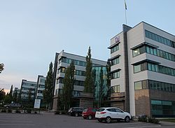 Buildings of Spektri, a business park in Pohjois-Tapiola | |
 Location of Pohjois-Tapiola (red) within Espoo (light green) and Suur-Tapiola (dark green) | |
| Coordinates: 60°11′45″N 24°47′30″E / 60.19583°N 24.79167°E / 60.19583; 24.79167 | |
| Country |  Finland Finland |
| Region |  Uusimaa Uusimaa |
| Sub-region | Greater Helsinki |
| Municipality |  Espoo Espoo |
| Main District | Suur-Tapiola |
| Area | |
| • Total | 2.2 km2 (0.8 sq mi) |
| Population (2006) | |
| • Total | 6,035 |
| • Density | 2,700/km2 (7,100/sq mi) |
| Languages | |
| • Finnish | 91.8 % |
| • Swedish | 5.3 % |
| • Other | 2.9 % |
| Postal Code(s) | 02130 |
| Jobs | 2,513 |
Pohjois-Tapiola (Swedish: Norra Hagalund) is a district of the municipality of Espoo, Finland.[1][2]
See also
- Districts of Espoo
References
- v
- t
- e
The major districts and districts of Espoo
- Bodom
- Kalajärvi
- Lahnus
- Lakisto
- Luukki (Luk)
- Niipperi (Nipert)
- Perusmäki (Grundbacka)
- Röylä (Rödskog)
- Vanhakartano (Gammelgård)
- Velskola (Vällskog)

- Espoonkartano (Esbogård)
- Kauklahti (Köklax)
- Kurttila (Kurtby)
- Vanttila (Fantsby)
- Haukilahti (Gäddvik)
- Keilaniemi (Kägeludden)
- Laajalahti (Bredvik)
- Mankkaa (Mankans)
- Niittykumpu (Ängskulla)
- Otaniemi (Otnäs)
- Pohjois-Tapiola (Norra Hagalund)
- Tapiola (Hagalund)
- Westend
- Espoon keskus (Esbo centrum)
- Gumböle
- Högnäs
- Järvenperä (Träskända)
- Karhusuo (Björnkärr)
- Karvasmäki (Karvasbacka)
- Kaupunginkallio (Stadsberget)
- Kolmperä (Kolmpers)
- Kunnarla (Gunnars)
- Kuurinniitty (Kurängen)
- Muurala (Morby)
- Nupuri (Nupurböle)
- Nuuksio (Noux)
- Siikajärvi
- Vanha-Nuuksio (Gamla Noux)
 | This Southern Finland location article is a stub. You can help Wikipedia by expanding it. |
- v
- t
- e


