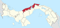
Santa Rosa, Colón
Corregimiento in Colón, Panama
Santa Rosa | |
|---|---|
Corregimiento | |
| Country |  Panama Panama |
| Province | Colón |
| District | Colón |
| Area [1] | |
| • Land | 26.8 km2 (10.3 sq mi) |
| Population (2010)[1] | |
| • Total | 987 |
| • Density | 36.8/km2 (95/sq mi) |
| Population density calculated based on land area. | |
| Time zone | UTC−5 (EST) |
Santa Rosa is a corregimiento in Colón District, Colón Province, Panama with a population of 987 as of 2010.[1] Its population as of 1990 was 533; its population as of 2000 was 735.[1]
References
- ^ a b c d "Cuadro 11 (Superficie, población y densidad de población en la República...)" [Table 11 (Area, population, and population density in the Republic...)] (.xls). In "Resultados Finales Básicos" [Basic Final Results] (in Spanish). National Institute of Statistics and Census of Panama. Retrieved May 26, 2015.
- v
- t
- e

Capital: Colón
- Achiote
- El Guabo
- La Encantada
- Nuevo Chagres
- Palmas Bellas
- Piña
- Salud
- Barrio Norte
- Barrio Sur
- Buena Vista
- Cativá
- Ciricito
- Colón City
- Cristóbal
- Escobal
- Limón
- Nueva Providencia
- Puerto Pilón
- Sabanitas
- Salamanca
- San Juan
- Santa Rosa
- San José del General
- San Juan de Turbe
- Nueva Esperanza
9°11′00″N 79°39′00″W / 9.1833°N 79.6500°W / 9.1833; -79.6500
This article about the geography of Colón Province is a stub. You can help Wikipedia by expanding it. |
- v
- t
- e


 Santa_Rosa,_Colón