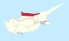
Sychari
Village in Kyrenia District, Cyprus
Sychari (de jure) |  Cyprus Cyprus | |
|---|---|---|
| • District | Kyrenia District | |
| Country (de facto) |  Northern Cyprus[1] Northern Cyprus[1] | |
| • District | Girne District | |
| Population (2011)[2] | ||
| • Total | 290 | |
| Time zone | UTC+2 (EET) | |
| • Summer (DST) | UTC+3 (EEST) | |
Sychari or Sichari (Greek: Συγχαρί [locally [sixːaˈɾi]]; Turkish: Aşağı Taşkent or Kaynakköy)[3] is a village in the Kyrenia District of Cyprus. De facto, it is under the control of Northern Cyprus. Its population in 2011 was 290.[2]
References
- ^ In 1983, the Turkish Republic of Northern Cyprus unilaterally declared independence from the Republic of Cyprus. The de facto state is not recognised by any UN state except Turkey.
- ^ a b KKTC 2011 Nüfus ve Konut Sayımı [TRNC 2011 Population and Housing Census] (PDF), TRNC State Planning Organization, 6 August 2013, p. 20
- ^ "SICHARI", Internal Displacement in Cyprus, PRIO Cyprus Centre, retrieved 4 October 2014
- v
- t
- e
- Agia Eirini
- Agios Amvrosios
- Agios Epiktitos
- Agios Ermolaos
- Agios Georgios
- Agirda
- Agridaki
- Asomatos
- Bellapais
- Boğazköy
- Charkeia
- Diorios
- Elia
- Fotta
- Ftericha
- Kalograia
- Kampyli
- Karakoumi
- Karmi
- Karpaseia
- Kato Dikomo
- Kazafani
- Klepini
- Kömürcü
- Kontemenos
- Kormakitis
- Koutsovendis
- Krini
- Larnakas tis Lapithou
- Livera
- Motides
- Myrtou
- Orka
- Palaiosofos
- Panagra
- Pano Dikomo
- Pileri
- Sychari
- Sysklipos
- Templos
- Thermeia
- Trapeza
- Trimithi
- Vasileia
- Vouno
 | This Cyprus location article is a stub. You can help Wikipedia by expanding it. |
- v
- t
- e


