Uludere District
District in Şırnak Province, Turkey
District in Şırnak, Turkey
37°25′N 42°58′E / 37.417°N 42.967°E / 37.417; 42.967 (2023)
Uludere District is a district of the Şırnak Province of Turkey.[1] In 2023, the district had a population of 46,740.[2] The seat of the district is the town of Uludere.[1] Its area is 841 km2.[3]
The district was formed in 1957.[4]
Around 90% of the district is populated by Kurds from the Goyan tribe. The Kaşuran tribe also reside in the district.[5]
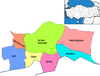
Settlements
Uludere District contains four beldes, seventeen villages of which two are unpopulated and moreover seven hamlets.[1][6]
Municipalities
- Hilal (Şêxan)
- Şenoba (Sêgirik)
- Uludere
- Uzungeçit (Dêra Hînê)
Villages
Population
Population history from 2007 to 2023:[2]
| Year | Pop. | ±% |
|---|---|---|
| 2007 | 37,894 | — |
| 2010 | 34,518 | −8.9% |
| 2015 | 42,386 | +22.8% |
| 2020 | 45,515 | +7.4% |
| 2023 | 46,740 | +2.7% |
Geography
Uludere's neighbors are: the district of Çukurca in the province of Hakkâri to the east; the districts of Şırnak and Silopi to the west; the district of Beytüşşebap to the north; and the country of Iraq to the south.[7]
The topography of Uludere consists mostly of rugged mountainous terrain. The Haftanîn and Kêla Meme (Kel Mehmet) mountains are the highest mountains in Uludere. In addition, Suwar, Serhe, Haftanîn, Meydan, Elcan and Şirîş are important plateaus. The altitude varies between 800 meters and 3200 meters throughout the district. The lowest altitude is in the Şenoba town and the highest altitude is in the Kel Mehmet (Kêla Meme) mountain.[7]
References
- ^ a b c "Türkiye Mülki İdare Bölümleri Envanteri". T.C. İçişleri Bakanlığı (in Turkish). Retrieved 19 December 2022.
- ^ a b "Population Of Municipalities, Villages And Quarters". TÜİK. Retrieved 10 May 2024.
- ^ "İl ve İlçe Yüz ölçümleri". General Directorate of Mapping. Retrieved 1 March 2023.
- ^ "İl İdaresi ve Mülki Bölümler Şube Müdürlüğü İstatistikleri - İl ve İlçe Kuruluş Tarihleri" (PDF) (in Turkish). p. 77. Retrieved 27 December 2022.
- ^ Baz, Ibrahim (2016). Şırnak aşiretleri ve kültürü (in Turkish). pp. 28 and 104. ISBN 9786058849631.
- ^ Baz, Ibrahim (2016). Şırnak aşiretleri ve kültürü (in Turkish). p. 24. ISBN 9786058849631.
- ^ a b "Uludere'de Coğrafi Yapı" ["Geography of Uludere"], an Uludere governmental webpage
- v
- t
- e
Uludere District in Şırnak Province of Turkey
- Beytüşşebap
- Cizre
- Güçlükonak
- İdil
- Silopi
- Şırnak
- Uludere

| Istanbul | |
|---|---|
| West Marmara | |
| Aegean | |
| East Marmara | |
| West Anatolia | |
| Mediterranean | |
| Central Anatolia | |
| West Black Sea | |
| East Black Sea | |
| Northeast Anatolia | |
| Central East Anatolia | |
| Southeast Anatolia | |
Metropolitan municipalities are bolded.
 | This article about a Southeastern Anatolia Region of Turkey location is a stub. You can help Wikipedia by expanding it. |
- v
- t
- e


