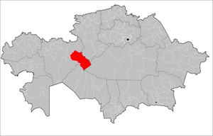
Yrgyz District
District in Aktobe Region, Kazakhstan
Yrgyz | |
|---|---|
District | |
| Yrğyz audany | |
 | |
| Country | Kazakhstan |
| Region | Aktobe Region |
| Administrative center | Yrgyz |
| Government | |
| • Akim | Kyzbergenov Nurlan Kasymkhanuly[1] |
| Population (2013)[2] | |
| • Total | 15,060 |
| Time zone | UTC+5 (West) |
Yrgyz District (Kazakh: Ырғыз ауданы, Yrğyz audany) is a district of Aktobe Region in Kazakhstan. The administrative center of the district is the selo of Yrgyz.[3] Population: 15,060 (2013 estimate);[2] 14,416 (2009 Census results);[4] 15,610 (1999 Census results).[4]
Geography
The area of Yrgyz District is 41,500 square kilometers (16,000 sq mi). Shalkarteniz is located in the district. The Lakes of the lower Turgay and Irgiz Nature Reserve is a protected area located in the district.[5]
References
- ^ "Акимат Иргизкого района". www.gov.kz.
- ^ a b "Население Республики Казахстан" (in Russian). Департамент социальной и демографической статистики. Retrieved 27 December 2013.
- ^ www.geonames.de Subdivisions of Kazakhstan in local languages
- ^ a b "Население Республики Казахстан" [Population of the Republic of Kazakhstan] (in Russian). Департамент социальной и демографической статистики. Retrieved 8 December 2013.
- ^ "M-41 Topographic Chart (in Russian)". Retrieved 23 July 2022.
- v
- t
- e
Aktobe Region
Capital: Aktobe
- Alga
- Ayteke Bi
- Bayganin
- Kargaly
- Kobda
- Khromtau
- Martuk
- Mugalzhar
- Oiyl
- Shalkar
- Temir
- Yrgyz

- Aktobe
- Alga
- Embi
- Kandyagash
- Khromtau
- Temir
- Shalkar
- Zhem
- Abay
- Akkemer
- Akrab
- Akshatau
- Aktobe
- Alga
- Algha
- Alimbet
- Alimbetovka
- Alpyspay
- Altykarasu
- Altyndy
- Altyqarasu
- Amangel'dy
- Anastas'evka
- Anastas'yevka
- Andreyevka
- Aqkemer
- Aqkol
- Aqqaytym
- Aqqum
- Aqshatau
- Aqyrap
- Aralcha
- Araltobe
- Araltogay
- Araltoghay
- Asha
- Ashchisay
- Astrakhanovka
- Ayke
- Badamsha
- Barshakum
- Barshaqum
- Basqudyq
- Batamshinskiy
- Batpakty
- Baturasay
- Bayganin
- Bayghanin
- Bayqadam
- Begaly
- Begimbet
- Belcher
- Bel'kopa
- Belogorka
- Berchogur
- Bestamak
- Bestamaq
- Birshoghyr
- Blagoveshchenskoye
- Boget
- Bogetsay
- Bogoslovka
- Bolgarka
- Borly
- Borodinovka
- Bozoy
- Brusilovka
- Chernovodsk
- Diyar
- Dmitrievskoe
- Dmitriyevskoye
- Dongyztau
- Dzhambul
- Embi
- Erzerum
- Georgiyevka
- Grigor'evka
- Grigor'yevka
- Il'inka
- Kair
- Kalinino
- Kalinovka
- Karabutak
- Karaganda
- Karagandy
- Karakhobda
- Karakol'
- Karaoy
- Karashokat
- Karauylkel'dy
- Kargalinskoye
- Kemer
- Kemershi
- Kengzhaly
- Kenkiyak
- Kenzhaly
- Kherson
- Khromtau
- Kirov
- Koktau
- Komintern
- Komsomol'skoe
- Konstantinovka, Kazakhstan
- Kopa
- Koptogay
- Kosbarmak
- Koshensay
- Kotrtas
- Kozhasay
- Kumkuduk
- Kumsay
- Kumzhargan
- Kurylys
- Kyrykkuduk
- Leninskoe
- Mamyt
- Martuk
- Maytobe
- Mikhaylovka
- Milysay
- Miyaly
- Mortyq
- Mugodzharskoye
- Murynqum
- Nagornoye
- Nikel'tau
- Nogayty
- Novaya baza
- Novaya zhizn'
- Novoaleksandrovka
- Novoalekseevka
- Novoalekseyevka
- Novodontsy
- Novomikhaylovka
- Novonadezhdinka
- Novoukrainka
- Novovvedenka
- Nura
- Oktyabr'sk
- Otradnoye
- Oysylkara
- Oyyl
- Pavlovka
- Perelyubovka
- Pervomayskoye
- Petropavlovka
- Petrovka
- Pokrovka
- Poltavka
- Pyatigorka
- Qarabutaq
- Qaraoba
- Qarasu
- Qaratoghay
- Qarghaly
- Qaynar
- Qopa
- Qopasor
- Qumsay
- Qumtoghay
- Qurylys
- Quyylys
- Qyryqqudyq
- Qyzylsay
- Rodniki
- Rodnikovka
- Rybakovka Sambay
- Sarat
- Sarbiye
- Saryat
- Sarybie
- Sarykol
- Saryqobda
- Saryqol
- Sarysay
- Shenbertal
- Shet-yrghyz
- Shevchenko
- Shilikti
- Shilikty
- Shubarkuduk
- Shubarqudyq
- Shubarshi
- Sorbulak
- Sorbulaq
- Soyuznoe
- Soyuznoye
- Staraya Masra
- Staritsky
- Stepanovka
- Studencheskoe
- Studencheskoye
- Sukhinovka
- Sulukol' Tabantal
- Taldyk
- Taldykum
- Taldyq
- Taldyqum
- Taldysay
- Tamdy
- Taskopa
- Tasotkel
- Tasotkel'
- Temir
- Ushkatty
- Uspenovka
- Yaysan
- Yebeyty
- Yrgyz
48°36′N 62°09′E / 48.600°N 62.150°E / 48.600; 62.150
 | This Aktobe Region location article is a stub. You can help Wikipedia by expanding it. |
- v
- t
- e


 Yrgyz_District