East Bowes
Plaats in Australië  | |||
|---|---|---|---|
  | |||
| Situering | |||
| Deelstaat | West-Australië | ||
| Local Government Area | Shire of Northampton | ||
| Coördinaten | 28° 20′ ZB, 114° 45′ OL | ||
| Algemeen | |||
| Inwoners (2021) | 46[1] | ||
| Hoogte | 17 m | ||
| Overig | |||
| Postcode | 6535 | ||
| Website | (en) Shire of Northampton | ||
| Detailkaart | |||
 | |||
| |||

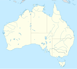
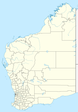
East Bowes is een plaats in de regio Mid West in West-Australië en maakt deel uit van het lokale bestuursgebied (LGA) Shire of Northampton, waarvan Northampton de hoofdplaats is. Het ligt net ten oosten van de North West Coastal Highway, ongeveer 470 kilometer ten noordnoordwesten van Perth. In 2021 telde East Bowes 46 inwoners.[1]
Externe link
- (en) Shire of Northampton
Referenties
- ↑ a b (en) 2021 Census QuickStats East Bowes. ABS. Gearchiveerd op 1 juli 2022. Geraadpleegd op 23 juli 2022.
Plaatsen in de regio Mid West
Abbotts · Ajana · Alma · Arrino · Arrowsmith · Austin · Big Bell · Binnu · Boogardie · Bowgada · Bunjil · Canna · Cape Burney · Carnamah · Caron · Coorow · Cuddingwarra · Cue · Day Dawn · Dongara · Drummond Cove · East Bowes · Eneabba · Eradu · Gabanintha · Geraldton · Green Head · Greenough · Gunyidi · Gutha · Horseshoe · Horrocks · Howatharra · Isseka · Kalbarri · Karalundi · Kojarena · Koolanooka · Kumarina · Latham · Leeman · Lennonville · Lynton · Mainland · Marchagee · Maya · Meekatharra · Merkanooka · Mingenew · Minnenooka · Moonyoonooka · Morawa · Mount Erin · Mount Magnet · Mullewa · Nabawa · Nangetty · Nannine · Nanson · Naraling · Narngulu · Narra Tarra · Northampton · Oakajee · Ogilvie · Paynes Find · Peak Hill · Paynesville · Perenjori · Pindar · Pintharuka · Porlell · Port Denison · Port Gregory · Protheroe · Reedy · Rothsay · Sandstone · Tardun · Tenindewa · Three Springs · Tuckanarra · Waggrakine · Walkaway · Warriedar · Whelarra · Wicherina · Wiluna · Winchester · Yalgoo · Yandanooka · Youanmi · Yoweragabbie · Yuna


 East_Bowes