Coayllo District
District in Lima, Peru
Coayllo Quwayllu | |
|---|---|
District | |
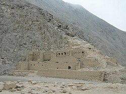 The ruins of Uquira | |
 Flag  Coat of arms | |
| Country |  Peru Peru |
| Region | Lima |
| Province | Cañete |
| Founded | July 28, 1821 |
| Capital | Coayllo |
| Government | |
| • Mayor | Alexander Chuquizuta Huapaya |
| Area | |
| • Total | 590.99 km2 (228.18 sq mi) |
| Elevation | 225 m (738 ft) |
| Population (2017) | |
| • Total | 1,043 |
| • Density | 1.8/km2 (4.6/sq mi) |
| Time zone | UTC-5 (PET) |
| UBIGEO | 150506 |
Coayllo District is one of sixteen districts of the province Cañete in Peru.[1]
References
- ^ (in Spanish) Instituto Nacional de Estadística e Informática. Banco de Información Distrital Archived April 23, 2008, at the Wayback Machine. Retrieved April 11, 2008.
- v
- t
- e

- Districts of Lima Region
- Peru

- Antioquia
- Callahuanca
- Carampoma
- Chicla
- Cuenca
- Huachupampa
- Huanza
- Huarochirí
- Lahuaytambo
- Langa
- Laraos
- Mariatana
- Matucana
- Ricardo Palma
- San Andrés de Tupicocha
- San Antonio
- San Bartolome
- San Damian
- San Juan de Iris
- San Juan de Tantaranche
- San Lorenzo de Quinti
- San Mateo
- San Mateo de Otao
- San Pedro de Casta
- San Pedro de Huancayre
- Sangallaya
- Santa Cruz de Cocachacra
- Santa Eulalia
- Santiago de Anchucaya
- Santiago de Tuna
- Santo Domingo de los Olleros
- Surco
 | This Lima Region geography article is a stub. You can help Wikipedia by expanding it. |
- v
- t
- e
12°43′39″S 76°27′35″W / 12.7275°S 76.4598°W / -12.7275; -76.4598


