Fall River Pass
Mountain pass in northern Colorado
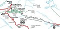
40°26′26″N 105°45′17″W / 40.44056°N 105.75472°W / 40.44056; -105.75472Fall River Pass (elevation 11,796 feet (3,595 m)) is a mountain pass in northern Colorado, in the Rocky Mountains of the western United States. It is located in the Front Range, within Rocky Mountain National Park. The pass is traversed by U.S. Highway 34 on Trail Ridge Road between Granby and Estes Park. However, as at Milner Pass on the Continental Divide, the road does not descend after reaching the pass from the west, but instead continues to climb along a side ridge; thus, neither pass is the high point on Trail Ridge Road, which crests at 12,183 feet (3,713 m) elevation, east of Fall River Pass, still within Rocky Mountain National Park. On the other hand, the old, largely unpaved, and one-way-uphill Fall River Road (see adjoining map) does have its summit at Fall River Pass, where it joins the modern highway for the descent to the west.
The Alpine Visitor Center, one of five visitor centers for Rocky Mountain National Park, is located at Fall River Pass. The highway has a moderately steep 6% grade on either side of this point.
Climate
Willow Park is a weather station near the summit of Fall River Pass. Willow Park has a subalpine climate (Köppen Dfc), bordering on an alpine climate (ETH), with only two months averaging over 10°C.
| Climate data for Willow Park, Colorado, 1991–2020 normals, 1988-2020 extremes: 10700ft (3261m) | |||||||||||||
|---|---|---|---|---|---|---|---|---|---|---|---|---|---|
| Month | Jan | Feb | Mar | Apr | May | Jun | Jul | Aug | Sep | Oct | Nov | Dec | Year |
| Record high °F (°C) | 63 (17) | 74 (23) | 73 (23) | 81 (27) | 85 (29) | 89 (32) | 93 (34) | 87 (31) | 82 (28) | 78 (26) | 69 (21) | 61 (16) | 93 (34) |
| Mean maximum °F (°C) | 45 (7) | 46 (8) | 53 (12) | 58 (14) | 66 (19) | 71 (22) | 74 (23) | 73 (23) | 69 (21) | 61 (16) | 51 (11) | 44 (7) | 76 (24) |
| Mean daily maximum °F (°C) | 28.5 (−1.9) | 29.9 (−1.2) | 38.1 (3.4) | 42.8 (6.0) | 51.4 (10.8) | 60.1 (15.6) | 65.9 (18.8) | 63.4 (17.4) | 57.5 (14.2) | 46.2 (7.9) | 34.6 (1.4) | 27.1 (−2.7) | 45.5 (7.5) |
| Daily mean °F (°C) | 17.9 (−7.8) | 18.8 (−7.3) | 25.7 (−3.5) | 30.2 (−1.0) | 38.5 (3.6) | 47.1 (8.4) | 52.4 (11.3) | 50.6 (10.3) | 44.9 (7.2) | 34.6 (1.4) | 24.3 (−4.3) | 16.8 (−8.4) | 33.5 (0.8) |
| Mean daily minimum °F (°C) | 7.2 (−13.8) | 7.3 (−13.7) | 13.1 (−10.5) | 18.2 (−7.7) | 26.0 (−3.3) | 33.1 (0.6) | 38.9 (3.8) | 37.7 (3.2) | 32.5 (0.3) | 23.5 (−4.7) | 14.3 (−9.8) | 6.9 (−13.9) | 21.6 (−5.8) |
| Mean minimum °F (°C) | −12 (−24) | −10 (−23) | −6 (−21) | 2 (−17) | 11 (−12) | 26 (−3) | 33 (1) | 31 (−1) | 20 (−7) | 5 (−15) | −5 (−21) | −13 (−25) | −17 (−27) |
| Record low °F (°C) | −24 (−31) | −34 (−37) | −17 (−27) | −18 (−28) | −2 (−19) | 11 (−12) | 28 (−2) | 20 (−7) | 7 (−14) | −20 (−29) | −22 (−30) | −21 (−29) | −34 (−37) |
| Average precipitation inches (mm) | 3.87 (98) | 3.79 (96) | 3.75 (95) | 4.87 (124) | 3.92 (100) | 1.83 (46) | 1.95 (50) | 2.15 (55) | 2.16 (55) | 2.86 (73) | 3.33 (85) | 3.60 (91) | 38.08 (968) |
| Source 1: XMACIS2[1] | |||||||||||||
| Source 2: NOAA (Precipitation)[2] | |||||||||||||
Picture gallery
-
 Map By USGS

-
 2.3 Miles High
 -
 Creek At Fall River Pass


References
External links
- USGS TopoZone listing
- Official Site
40°26′26″N 105°45′17″W / 40.44056°N 105.75472°W / 40.44056; -105.75472
- v
- t
- e
- Alpine Visitor Center
- Alpine Tundra Research
- Beaver Meadows Visitor Center
- Agnes Vaille Shelter
- Dutchtown (ghost town)
- Fall River Pass
- Horseshoe Park
- Kawuneeche Valley
- Lulu City (ghost town)
- Lumpy Ridge
- Middle Park
- Milner Pass (Continental Divide)
- Moraine Park Museum and Amphitheater
- Petit Grepon (spire)
- Tuxedo Park
- Upper Beaver Meadows
- Wild Basin
| Peaks |
|
|---|---|
| Hiking trails and technical climbs |
|
| Glaciers |
|
| Bodies of water |
|
- History of Rocky Mountain National Park
- NRHP listings in RMNP
- NRHP in Rocky Mountain NP template
- Districts or areas
& camping
- Park Roads
- Highways
- Denver International Airport
- Denver Union Station
- RTD
municipalities
geography
information
- Rocky Mountain National Park Category
- Colorado Portal
Authority control databases | |
|---|---|
| International |
|
| Other |
|


