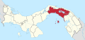
Tocumen
Corregimiento in Panamá, Panama
9°4′48″N 79°22′48″W / 9.08000°N 79.38000°W / 9.08000; -79.38000 Panama
[1]
(2010)[1]
Tocumen is a city and corregimiento in Panamá District, Panamá Province, Panama with a population of 74,952 as of 2010.[1] Its population as of 1990 was 47,032; its population as of 2000 was 83,187.[1] It is the site of the Tocumen International Airport.
Climate
According to the Köppen Climate Classification system, Tocumen has a tropical monsoon climate, abbreviated "Am" on climate maps.
| Climate data for Tocumen | |||||||||||||
|---|---|---|---|---|---|---|---|---|---|---|---|---|---|
| Month | Jan | Feb | Mar | Apr | May | Jun | Jul | Aug | Sep | Oct | Nov | Dec | Year |
| Mean daily maximum °C (°F) | 36.0 (96.8) | 36.6 (97.9) | 37.0 (98.6) | 37.6 (99.7) | 38.0 (100.4) | 38.0 (100.4) | 36.0 (96.8) | 38.0 (100.4) | 35.4 (95.7) | 35.2 (95.4) | 35.0 (95.0) | 35.5 (95.9) | 36.5 (97.8) |
| Daily mean °C (°F) | 26.6 (79.9) | 27.0 (80.6) | 27.5 (81.5) | 27.8 (82.0) | 27.4 (81.3) | 27.0 (80.6) | 27.0 (80.6) | 27.0 (80.6) | 26.7 (80.1) | 26.4 (79.5) | 26.5 (79.7) | 26.6 (79.9) | 27.0 (80.5) |
| Mean daily minimum °C (°F) | 16.5 (61.7) | 16.0 (60.8) | 16.0 (60.8) | 15.8 (60.4) | 19.0 (66.2) | 19.5 (67.1) | 19.7 (67.5) | 17.5 (63.5) | 20.0 (68.0) | 17.8 (64.0) | 18.5 (65.3) | 17.0 (62.6) | 17.8 (64.0) |
| Average rainfall mm (inches) | 26.4 (1.04) | 10.0 (0.39) | 15.2 (0.60) | 69.6 (2.74) | 231.6 (9.12) | 234.7 (9.24) | 172.4 (6.79) | 218.0 (8.58) | 246.8 (9.72) | 326.3 (12.85) | 240.9 (9.48) | 100.6 (3.96) | 1,892.5 (74.51) |
| Average relative humidity (%) | 69.6 | 66.1 | 64.9 | 67.7 | 78.2 | 80.6 | 79.6 | 80.3 | 81.2 | 82.4 | 81.9 | 75.3 | 75.6 |
| Mean monthly sunshine hours | 211.9 | 203.7 | 211.2 | 179.6 | 127.5 | 97.4 | 110.5 | 111.9 | 113.2 | 114.3 | 126.6 | 171.3 | 1,779.1 |
| Source: [2] | |||||||||||||
References
- ^ a b c d "Cuadro 11 (Superficie, población y densidad de población en la República...)" [Table 11 (Area, population, and population density in the Republic...)] (.xls). In "Resultados Finales Básicos" [Basic Final Results] (in Spanish). National Institute of Statistics and Census of Panama. Retrieved May 26, 2015.
- ^ "Datos Historicos- Hidrometeorologica de ETESA". ETESA. Retrieved October 9, 2012.
- v
- t
- e
Capital: Panama
- San Miguel
- La Ensenada
- La Esmeralda
- La Guinea
- Pedro González
- Saboga
- Chepo
- Cañita
- Chepillo
- El Llano
- Las Margaritas
- Santa Cruz de Chinina
- Madungandí
- Tortí
- Chimán
- Brujas
- Gonzalo Vásquez
- Pásiga
- Unión Santeña
Authority control databases | |
|---|---|
| International |
|
| National |
|
This article about the geography of Panamá Province is a stub. You can help Wikipedia by expanding it. |
- v
- t
- e


 Tocumen