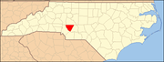
National Register of Historic Places listings in Cabarrus County, North Carolina
Map all coordinates using OpenStreetMap
Download coordinates as:
- KML
- GPX (all coordinates)
- GPX (primary coordinates)
- GPX (secondary coordinates)

This list includes properties and districts listed on the National Register of Historic Places in Cabarrus County, North Carolina. Click the "Map of all coordinates" link to the right to view an online map of all properties and districts with latitude and longitude coordinates in the table below.[1]
Current listings
This National Park Service list is complete through NPS recent listings posted July 12, 2024.[2]
| [3] | Name on the Register[4] | Image | Date listed[5] | Location | City or town | Description |
|---|---|---|---|---|---|---|
| 1 | Barber-Scotia College |  | February 28, 1985 (#85000378) | 145 Cabarrus Ave. West 35°24′23″N 80°35′09″W / 35.406389°N 80.585833°W / 35.406389; -80.585833 (Barber-Scotia College) | Concord | |
| 2 | Bethel Church Arbor |  | May 23, 1997 (#97000472) | Jct of SR 1123 and SR 1121 35°14′27″N 80°32′12″W / 35.240833°N 80.536667°W / 35.240833; -80.536667 (Bethel Church Arbor) | Midland | Bethel Church Arbor is a historic religious shelter for Methodist camp meetings located at Midland, North Carolina. It was built about 1878 and is an open rectangular structure topped by a metal-clad hipped roof. |
| 3 | Boger-Hartsell Farm | Upload image | July 23, 1998 (#98000890) | Jct. of US 601 and SR 1148 35°18′53″N 80°31′00″W / 35.314722°N 80.516667°W / 35.314722; -80.516667 (Boger-Hartsell Farm) | Concord | |
| 4 | Bost Mill Historic District | Upload image | January 13, 1986 (#86000076) | N and S sides of NC 200 off US 601 35°19′32″N 80°30′08″W / 35.325556°N 80.502222°W / 35.325556; -80.502222 (Bost Mill Historic District) | Georgeville | Bost Mill Historic District is a national historic district located near Georgeville, North Carolina. The district has 10 buildings and 3 sites associated with the Bost Mill grain and cotton operation. |
| 5 | Cabarrus County Courthouse | 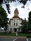 | June 5, 1974 (#74001328) | Union St., S. 35°24′37″N 80°34′52″W / 35.410278°N 80.581111°W / 35.410278; -80.581111 (Cabarrus County Courthouse) | Concord | |
| 6 | Coleman-Franklin-Cannon Mill |  | April 16, 2015 (#15000161) | 625 Main St., SW. 35°23′14″N 80°35′24″W / 35.3873°N 80.5899°W / 35.3873; -80.5899 (Coleman-Franklin-Cannon Mill) | Concord | |
| 7 | Dr. Charles Favoni-Harris and William Shakespeare House | Upload image | March 5, 1986 (#86000413) | SR 1445 35°23′24″N 80°43′13″W / 35.39°N 80.720278°W / 35.39; -80.720278 (Dr. Charles Favoni-Harris and William Shakespeare House) | Poplar Tent | |
| 8 | First Congregational Church |  | January 9, 1986 (#86000030) | Corner of Wade and C Sts. 35°23′57″N 80°25′40″W / 35.399167°N 80.427778°W / 35.399167; -80.427778 (First Congregational Church) | Mount Pleasant | |
| 9 | Gem Theatre | Upload image | August 26, 2019 (#100004322) | 111 West 1st Street 35°29′54″N 80°37′29″W / 35.4983°N 80.6247°W / 35.4983; -80.6247 (Gem Theatre) | Kannapolis | |
| 10 | John Bunyan Green Farm | Upload image | June 2, 1988 (#88000651) | SR 1114 .5 miles E of SR 1178 35°12′56″N 80°29′23″W / 35.215556°N 80.489722°W / 35.215556; -80.489722 (John Bunyan Green Farm) | Midland | |
| 11 | Daniel Isenhour House and Farm | Upload image | April 21, 2000 (#00000392) | 11970 Mt. Olive Rd. 35°29′51″N 80°22′50″W / 35.4975°N 80.380556°W / 35.4975; -80.380556 (Daniel Isenhour House and Farm) | Gold Hill | |
| 12 | Lentz Hotel |  | June 14, 1982 (#82003438) | College St. 35°24′10″N 80°26′14″W / 35.402778°N 80.437222°W / 35.402778; -80.437222 (Lentz Hotel) | Mount Pleasant | The Lentz Hotel in Mount Pleasant, North Carolina, is an historic site built in 1853 that is the oldest commercial building in Cabarrus County, North Carolina. |
| 13 | McCurdy Log House | Upload image | January 21, 1974 (#74001329) | S of Concord off U.S. 601 35°19′03″N 80°32′32″W / 35.3175°N 80.542222°W / 35.3175; -80.542222 (McCurdy Log House) | Concord | |
| 14 | Meek House | Upload image | September 24, 2001 (#01001026) | NC 1624, 0.3 miles NE of jct. with SR 1622 35°15′18″N 80°36′05″W / 35.255115°N 80.6015101°W / 35.255115; -80.6015101 (Meek House) | Concord | |
| 15 | Mill Hill | Upload image | September 10, 1974 (#74001330) | W of Kannapolis on SR 1616 35°28′36″N 80°41′59″W / 35.476667°N 80.699722°W / 35.476667; -80.699722 (Mill Hill) | Concord | |
| 16 | Robert Harvey Morrison Farm and Pioneer Mills Gold Mine |  | December 31, 1990 (#90001952) | 730 Morrison Rd. 35°15′43″N 80°35′13″W / 35.261944°N 80.586944°W / 35.261944; -80.586944 (Robert Harvey Morrison Farm and Pioneer Mills Gold Mine) | Midland | |
| 17 | Mount Pleasant Collegiate Institute Historic District |  | November 15, 1979 (#79001686) | Jct. of NC 49 and NC 73 35°24′08″N 80°26′12″W / 35.402222°N 80.436667°W / 35.402222; -80.436667 (Mount Pleasant Collegiate Institute Historic District) | Mount Pleasant | |
| 18 | Mount Pleasant Historic District | 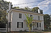 | May 12, 1986 (#86001050) | Roughly W. and E. Franklin between N. Halifax and C and N and N. and S. Main Sts. between Boston and Broad Sts. 35°24′03″N 80°26′06″W / 35.400833°N 80.435°W / 35.400833; -80.435 (Mount Pleasant Historic District) | Mount Pleasant | |
| 19 | Norcott Mill-Cannon Mills Company Plant No. 10 | Upload image | December 8, 2021 (#100007248) | 580, 594, 598 Cabarrus Ave. West; 569-581 Flora Ave. NW 35°23′53″N 80°36′04″W / 35.3980°N 80.6012°W / 35.3980; -80.6012 (Norcott Mill-Cannon Mills Company Plant No. 10) | Concord | |
| 20 | North Union Street Historic District |  | April 15, 1986 (#86000789) | Roughly bounded by Peachtree Ave. NW, Church St. N, Cobran Ave. SW, and Georgia St. NW and Spring St. N 35°24′46″N 80°35′13″W / 35.412778°N 80.586944°W / 35.412778; -80.586944 (North Union Street Historic District) | Concord | |
| 21 | Odell-Locke-Randolph Cotton Mill | 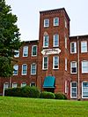 | March 28, 1983 (#83001838) | Buffalo, Church, Peachtree, and Locust Sts. 35°25′06″N 80°35′26″W / 35.418333°N 80.590556°W / 35.418333; -80.590556 (Odell-Locke-Randolph Cotton Mill) | Concord | |
| 22 | Harvey Jeremiah Peeler House |  | August 16, 2007 (#07000818) | 101 S. Ridge Ave. 35°29′50″N 80°37′24″W / 35.497222°N 80.623333°W / 35.497222; -80.623333 (Harvey Jeremiah Peeler House) | Kannapolis | |
| 23 | Rev. John E. Pressley House | Upload image | January 6, 1986 (#86000029) | N side of SR 1613 0.3 miles E of SR 1612 35°30′18″N 80°45′40″W / 35.505°N 80.761111°W / 35.505; -80.761111 (Rev. John E. Pressley House) | Bethpage | |
| 24 | Reed Gold Mine |  | October 15, 1966 (#66000587) | 11 miles SE of Concord 35°16′52″N 80°27′36″W / 35.281111°N 80.46°W / 35.281111; -80.46 (Reed Gold Mine) | Concord | The Reed Gold Mine is located in Midland, North Carolina, and is the site of the first documented commercial gold find in the United States. |
| 25 | Rocky River Presbyterian Church |  | March 6, 1986 (#86000419) | Jct. of SR 1139 and SR 1158 35°18′09″N 80°35′58″W / 35.3025°N 80.599444°W / 35.3025; -80.599444 (Rocky River Presbyterian Church) | Rocky River | |
| 26 | South Union Street Courthouse and Commercial Historic District |  | September 30, 1997 (#97001196) | Along Union St., bounded by Corban and Cabarrus Aves. 35°24′34″N 80°34′49″W / 35.409444°N 80.580278°W / 35.409444; -80.580278 (South Union Street Courthouse and Commercial Historic District) | Concord | |
| 27 | South Union Street Historic District |  | April 10, 1986 (#86000736) | Roughly bounded by Corban Ave. SW, S. Union St., Blume Ave. SE, and Spring St. SW 35°24′13″N 80°34′30″W / 35.403611°N 80.575000°W / 35.403611; -80.575000 (South Union Street Historic District) | Concord | |
| 28 | Spears House |  | August 7, 1989 (#89001046) | 1615 Morrison Rd. 35°15′14″N 80°36′10″W / 35.253889°N 80.602778°W / 35.253889; -80.602778 (Spears House) | Concord | |
| 29 | Stonewall Jackson Training School Historic District |  | March 15, 1984 (#84001966) | SR 1157 35°21′51″N 80°35′54″W / 35.364167°N 80.598333°W / 35.364167; -80.598333 (Stonewall Jackson Training School Historic District) | Concord | |
| 30 | Union Street North-Cabarrus Avenue Commercial Historic District | Upload image | December 10, 2003 (#03001272) | Roughly Union St. N, Cabarrus Ave. E, Cabarrus Ave. W, and Church St. S 35°24′38″N 80°34′53″W / 35.410556°N 80.581389°W / 35.410556; -80.581389 (Union Street North-Cabarrus Avenue Commercial Historic District) | Concord |
See also
Wikimedia Commons has media related to National Register of Historic Places in Cabarrus County, North Carolina.
- National Register of Historic Places listings in North Carolina
- List of National Historic Landmarks in North Carolina
References
- ^ The latitude and longitude information provided in this table was derived originally from the National Register Information System, which has been found to be fairly accurate for about 99% of listings. Some locations in this table may have been corrected to current GPS standards.
- ^ National Park Service, United States Department of the Interior, "National Register of Historic Places: Weekly List Actions", retrieved July 12, 2024.
- ^ Numbers represent an alphabetical ordering by significant words. Various colorings, defined here, differentiate National Historic Landmarks and historic districts from other NRHP buildings, structures, sites or objects.
- ^ "National Register Information System". National Register of Historic Places. National Park Service. April 24, 2008.
- ^ The eight-digit number below each date is the number assigned to each location in the National Register Information System database, which can be viewed by clicking the number.
- v
- t
- e

by county
- Alamance
- Alexander
- Alleghany
- Anson
- Ashe
- Avery
- Beaufort
- Bertie
- Bladen
- Brunswick
- Buncombe
- Burke
- Cabarrus
- Caldwell
- Camden
- Carteret
- Caswell
- Catawba
- Chatham
- Cherokee
- Chowan
- Clay
- Cleveland
- Columbus
- Craven
- Cumberland
- Currituck
- Dare
- Davidson
- Davie
- Duplin
- Durham
- Edgecombe
- Forsyth
- Franklin
- Gaston
- Gates
- Graham
- Granville
- Greene
- Guilford
- Halifax
- Harnett
- Haywood
- Henderson
- Hertford
- Hoke
- Hyde
- Iredell
- Jackson
- Johnston
- Jones
- Lee
- Lenoir
- Lincoln
- Macon
- Madison
- Martin
- McDowell
- Mecklenburg
- Mitchell
- Montgomery
- Moore
- Nash
- New Hanover
- Northampton
- Onslow
- Orange
- Pamlico
- Pasquotank
- Pender
- Perquimans
- Person
- Pitt
- Polk
- Randolph
- Richmond
- Robeson
- Rockingham
- Rowan
- Rutherford
- Sampson
- Scotland
- Stanly
- Stokes
- Surry
- Swain
- Transylvania
- Tyrrell
- Union
- Vance
- Wake
- Warren
- Washington
- Watauga
- Wayne
- Wilkes
- Wilson
- Yadkin
- Yancey
| |
|---|---|
| Topics | |
| Lists by state |
|
| Lists by insular areas | |
| Lists by associated state | |
| Other areas | |
| Related | |
| |